
USA September 2025

Hier kommen die Bilder der Tour, zusammengefasst auf einer Seite (kann zu längeren Ladezeiten führen).
These are the pictures of the trip, all together on one page (may need longer time to load).
Als Bilderklärung gibt es hier Aufnahmezeitpunkt und direkten Kartenlink zum ungefähren Fotostandpunkt. Außerdem alle in der Bilddatei enthaltenen Stichwörter. Diese Daten sind in der Fotodatei enthalten und werden automatisch vom Browser ausgelesen und angezeigt. Wie die Stichwörter zu lesen sind, erfahrt Ihr hier.
As Explanations you will find the exposure time and a direct map link to the approximate viewpoint from which the picture was taken. Additional you can watch all keywords connected to the photo (german language). All these datas are included in the picture file and automatically read by your browser. The meaning of the keywords are translated and explained here.
Nicht wundern: Da die Systematik auf Bahnbilder zugeschnitten ist, wird zur Vereinheitlichung auch bei reinen Landschaftsbildern der Name der nächsten Bahnstation genannt.
Don't wonder in case of pictures with only landscape : The keywords are mainly made for train pictures. So also for landscape pictures the name of the next station is mentioned.
Von Bild zu Bild durch Klick auf das Foto! Zum ersten Bild.
Switch to the next picture by clicking on the photo. To the first photo.
Der Link zum ausführlichen Reisebericht / Link to the full journey report (only german!):
Nett hier, aber haben Sie das schon mal mit Zug gesehen?
.
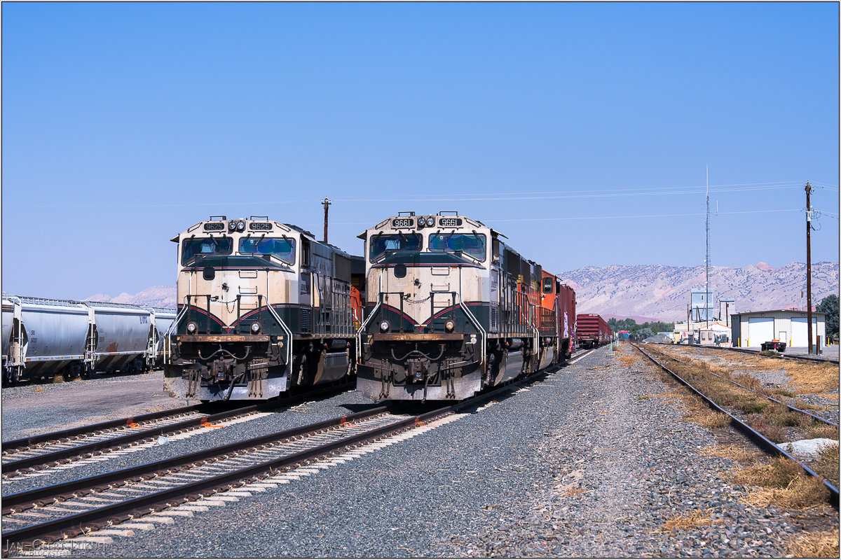
Bild 01. Aufnahmezeitpunkt/Recording time: 06.09.2025 um/at 12:11. Der ungefähre Fotostandpunkt auf/The approximate photo point on Google Maps. nächstes/next hoch/top
Kurzbeschreibung durch hinterlegte Stichwörter/Short description by included keywords:
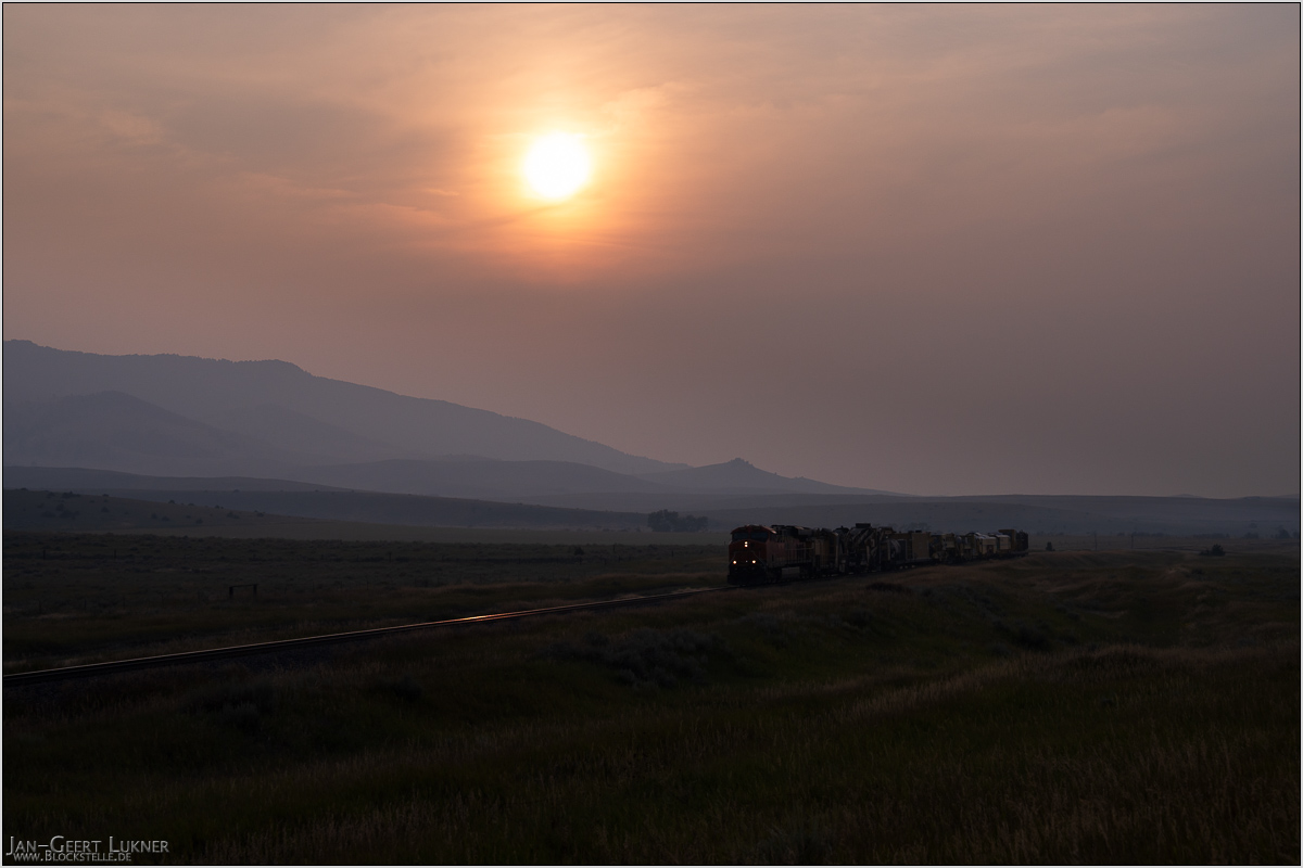
Bild 02. Aufnahmezeitpunkt/Recording time: 06.09.2025 um/at 19:01. Der ungefähre Fotostandpunkt auf/The approximate photo point on Google Maps. nächstes/next hoch/top
Kurzbeschreibung durch hinterlegte Stichwörter/Short description by included keywords:
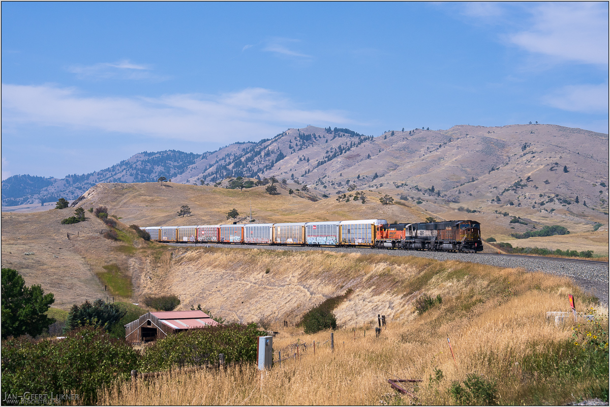
Bild 03. Aufnahmezeitpunkt/Recording time: 07.09.2025 um/at 13:20. Der ungefähre Fotostandpunkt auf/The approximate photo point on Google Maps. nächstes/next hoch/top
Kurzbeschreibung durch hinterlegte Stichwörter/Short description by included keywords:
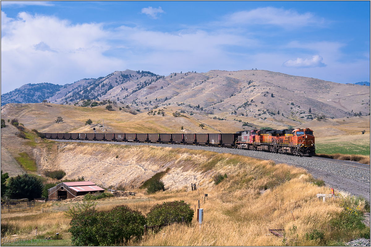
Bild 04. Aufnahmezeitpunkt/Recording time: 07.09.2025 um/at 14:07. Der ungefähre Fotostandpunkt auf/The approximate photo point on Google Maps. nächstes/next hoch/top
Kurzbeschreibung durch hinterlegte Stichwörter/Short description by included keywords:
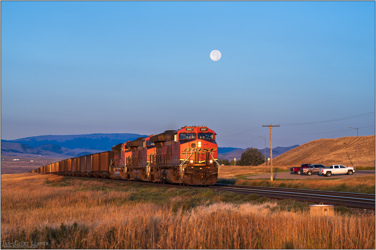
Bild 05. Aufnahmezeitpunkt/Recording time: 08.09.2025 um/at 07:13. Der ungefähre Fotostandpunkt auf/The approximate photo point on Google Maps. nächstes/next hoch/top
Kurzbeschreibung durch hinterlegte Stichwörter/Short description by included keywords:
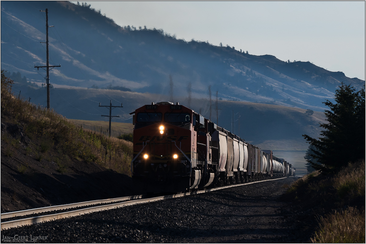
Bild 06. Aufnahmezeitpunkt/Recording time: 08.09.2025 um/at 08:21. Der ungefähre Fotostandpunkt auf/The approximate photo point on Google Maps. nächstes/next hoch/top
Kurzbeschreibung durch hinterlegte Stichwörter/Short description by included keywords:
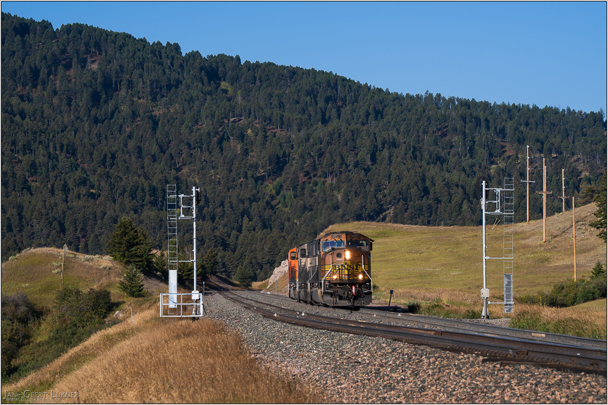
Bild 07. Aufnahmezeitpunkt/Recording time: 08.09.2025 um/at 08:56. Der ungefähre Fotostandpunkt auf/The approximate photo point on Google Maps. nächstes/next hoch/top
Kurzbeschreibung durch hinterlegte Stichwörter/Short description by included keywords:
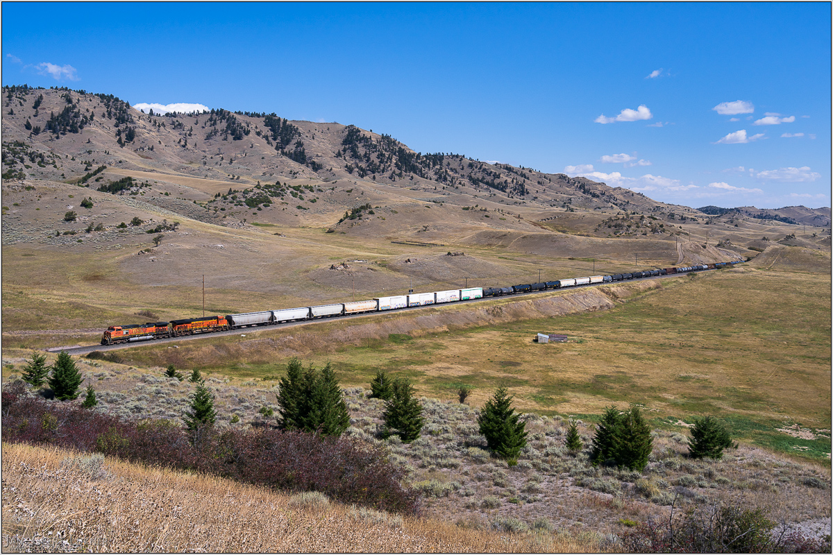
Bild 08. Aufnahmezeitpunkt/Recording time: 08.09.2025 um/at 12:56. Der ungefähre Fotostandpunkt auf/The approximate photo point on Google Maps. nächstes/next hoch/top
Kurzbeschreibung durch hinterlegte Stichwörter/Short description by included keywords:
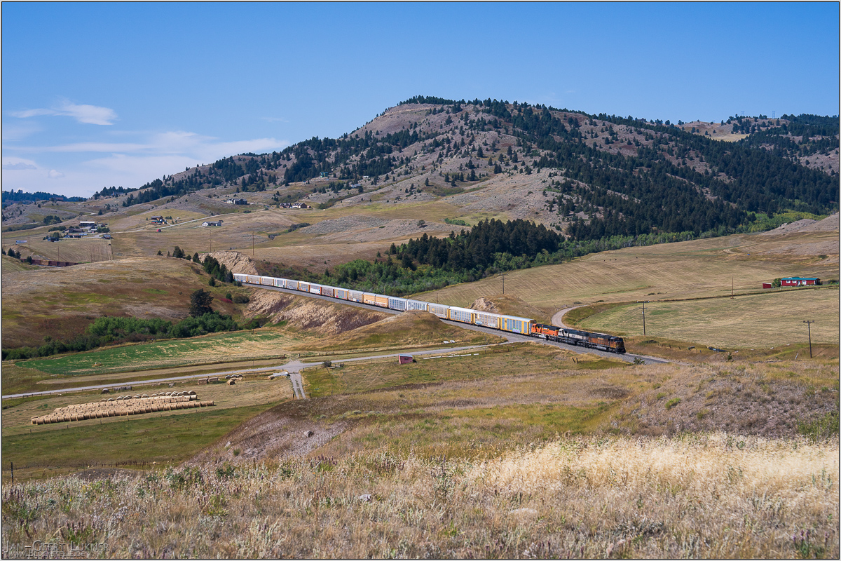
Bild 09. Aufnahmezeitpunkt/Recording time: 08.09.2025 um/at 13:05. Der ungefähre Fotostandpunkt auf/The approximate photo point on Google Maps. nächstes/next hoch/top
Kurzbeschreibung durch hinterlegte Stichwörter/Short description by included keywords:
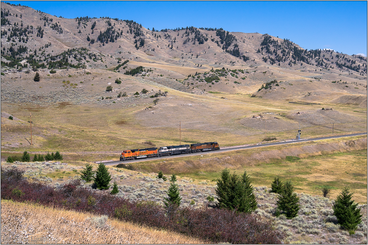
Bild 10. Aufnahmezeitpunkt/Recording time: 08.09.2025 um/at 13:34. Der ungefähre Fotostandpunkt auf/The approximate photo point on Google Maps. nächstes/next hoch/top
Kurzbeschreibung durch hinterlegte Stichwörter/Short description by included keywords:
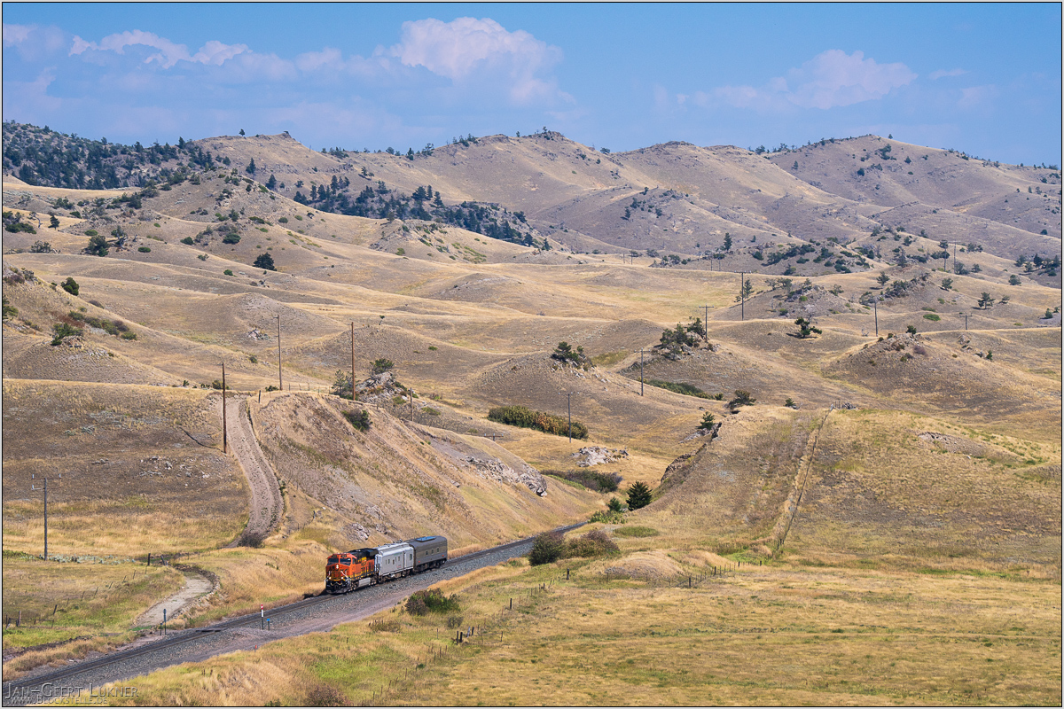
Bild 11. Aufnahmezeitpunkt/Recording time: 08.09.2025 um/at 14:36. Der ungefähre Fotostandpunkt auf/The approximate photo point on Google Maps. nächstes/next hoch/top
Kurzbeschreibung durch hinterlegte Stichwörter/Short description by included keywords:
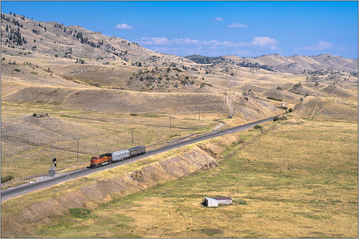
Bild 12. Aufnahmezeitpunkt/Recording time: 08.09.2025 um/at 14:36. Der ungefähre Fotostandpunkt auf/The approximate photo point on Google Maps. nächstes/next hoch/top
Kurzbeschreibung durch hinterlegte Stichwörter/Short description by included keywords:
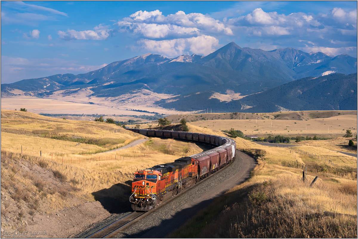
Bild 13. Aufnahmezeitpunkt/Recording time: 08.09.2025 um/at 18:04. Der ungefähre Fotostandpunkt auf/The approximate photo point on Google Maps. nächstes/next hoch/top
Kurzbeschreibung durch hinterlegte Stichwörter/Short description by included keywords:
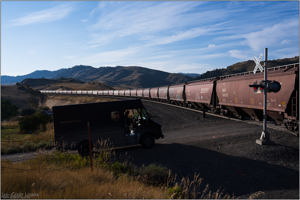
Bild 14. Aufnahmezeitpunkt/Recording time: 08.09.2025 um/at 18:11. Der ungefähre Fotostandpunkt auf/The approximate photo point on Google Maps. nächstes/next hoch/top
Kurzbeschreibung durch hinterlegte Stichwörter/Short description by included keywords:
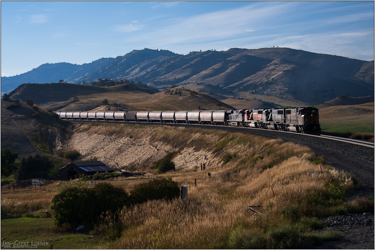
Bild 15. Aufnahmezeitpunkt/Recording time: 08.09.2025 um/at 18:13. Der ungefähre Fotostandpunkt auf/The approximate photo point on Google Maps. nächstes/next hoch/top
Kurzbeschreibung durch hinterlegte Stichwörter/Short description by included keywords:
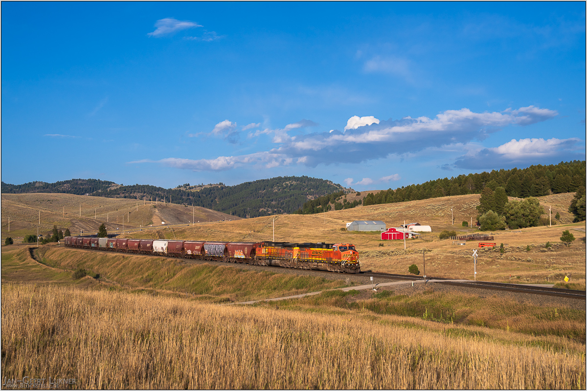
Bild 16. Aufnahmezeitpunkt/Recording time: 08.09.2025 um/at 18:54. Der ungefähre Fotostandpunkt auf/The approximate photo point on Google Maps. nächstes/next hoch/top
Kurzbeschreibung durch hinterlegte Stichwörter/Short description by included keywords:
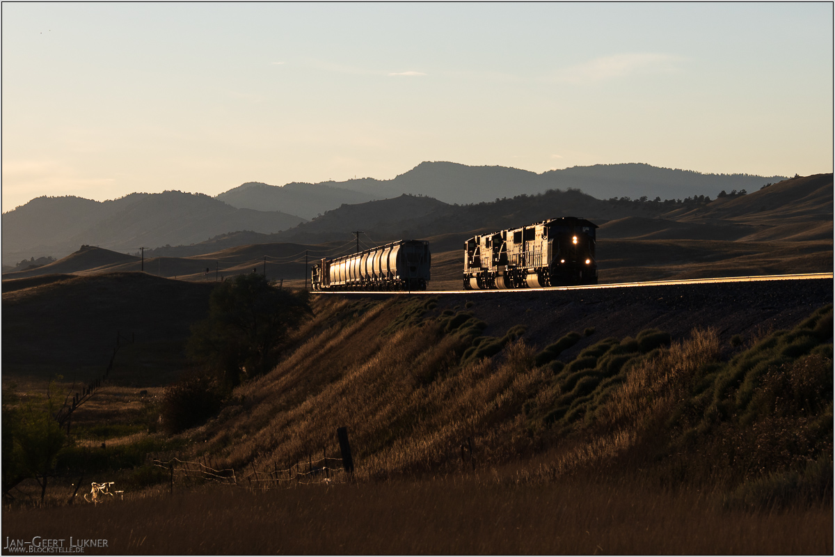
Bild 17. Aufnahmezeitpunkt/Recording time: 08.09.2025 um/at 19:13. Der ungefähre Fotostandpunkt auf/The approximate photo point on Google Maps. nächstes/next hoch/top
Kurzbeschreibung durch hinterlegte Stichwörter/Short description by included keywords:
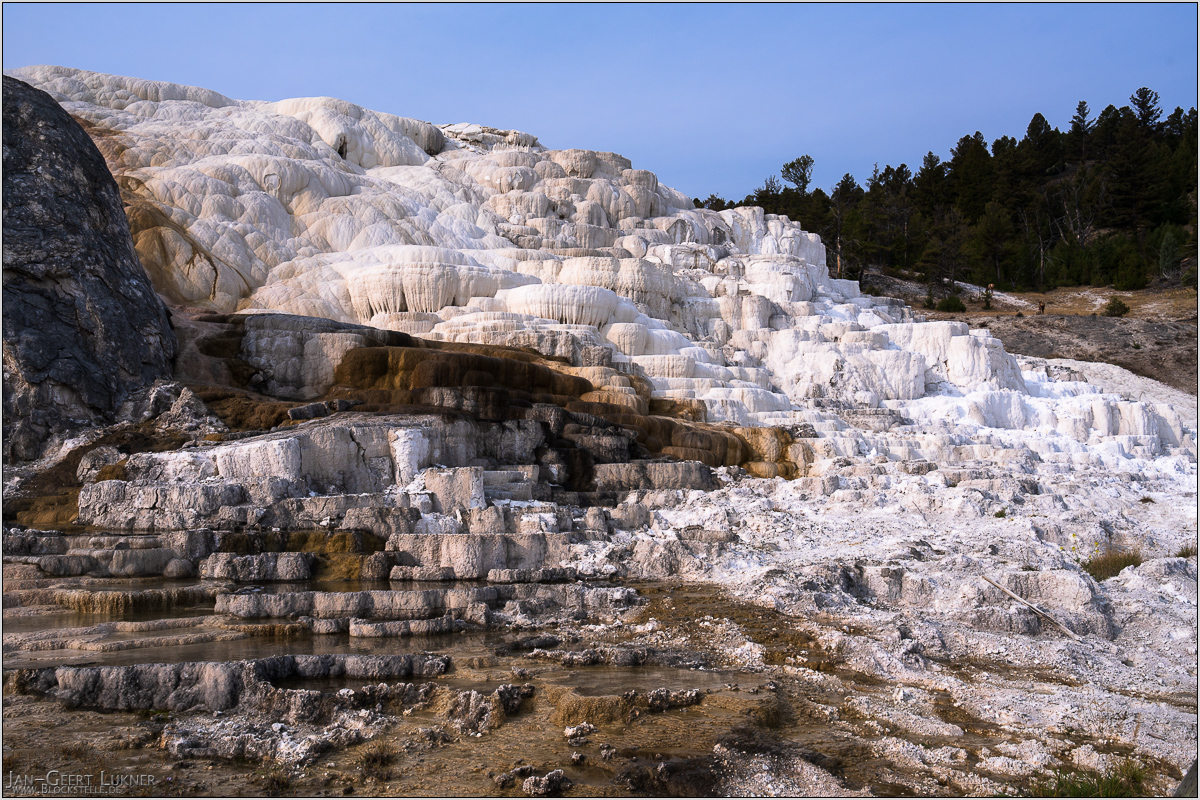
Bild 18. Aufnahmezeitpunkt/Recording time: 09.09.2025 um/at 09:29. Der ungefähre Fotostandpunkt auf/The approximate photo point on Google Maps. nächstes/next hoch/top
Kurzbeschreibung durch hinterlegte Stichwörter/Short description by included keywords:
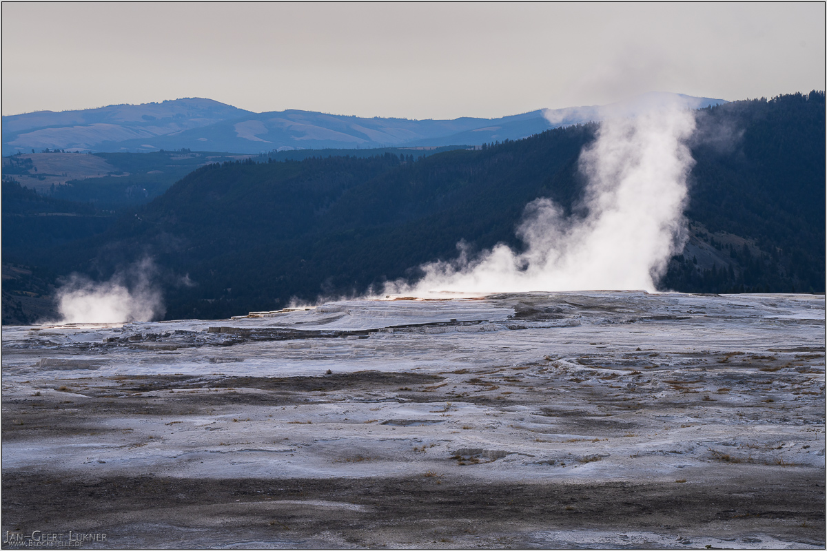
Bild 19. Aufnahmezeitpunkt/Recording time: 09.09.2025 um/at 09:51. Der ungefähre Fotostandpunkt auf/The approximate photo point on Google Maps. nächstes/next hoch/top
Kurzbeschreibung durch hinterlegte Stichwörter/Short description by included keywords:
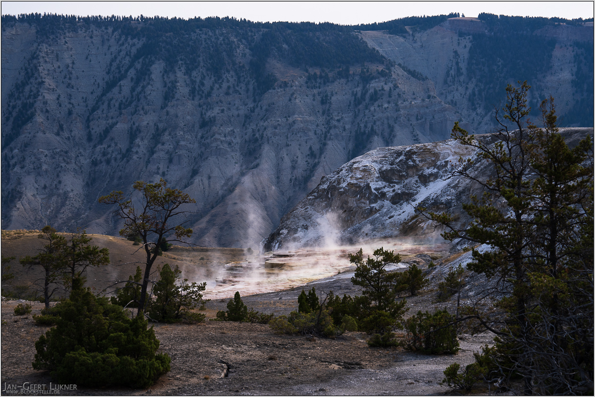
Bild 20. Aufnahmezeitpunkt/Recording time: 09.09.2025 um/at 09:55. Der ungefähre Fotostandpunkt auf/The approximate photo point on Google Maps. nächstes/next hoch/top
Kurzbeschreibung durch hinterlegte Stichwörter/Short description by included keywords:
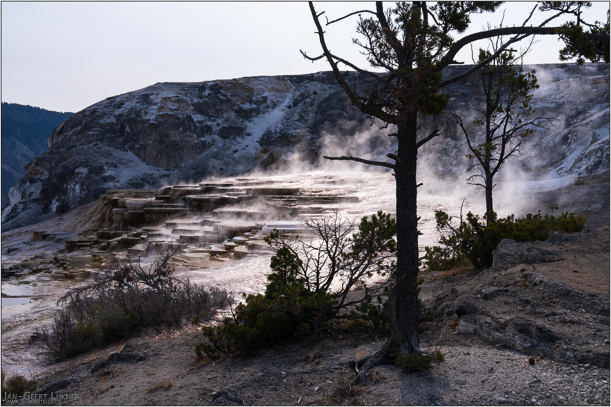
Bild 21. Aufnahmezeitpunkt/Recording time: 09.09.2025 um/at 09:58. Der ungefähre Fotostandpunkt auf/The approximate photo point on Google Maps. nächstes/next hoch/top
Kurzbeschreibung durch hinterlegte Stichwörter/Short description by included keywords:
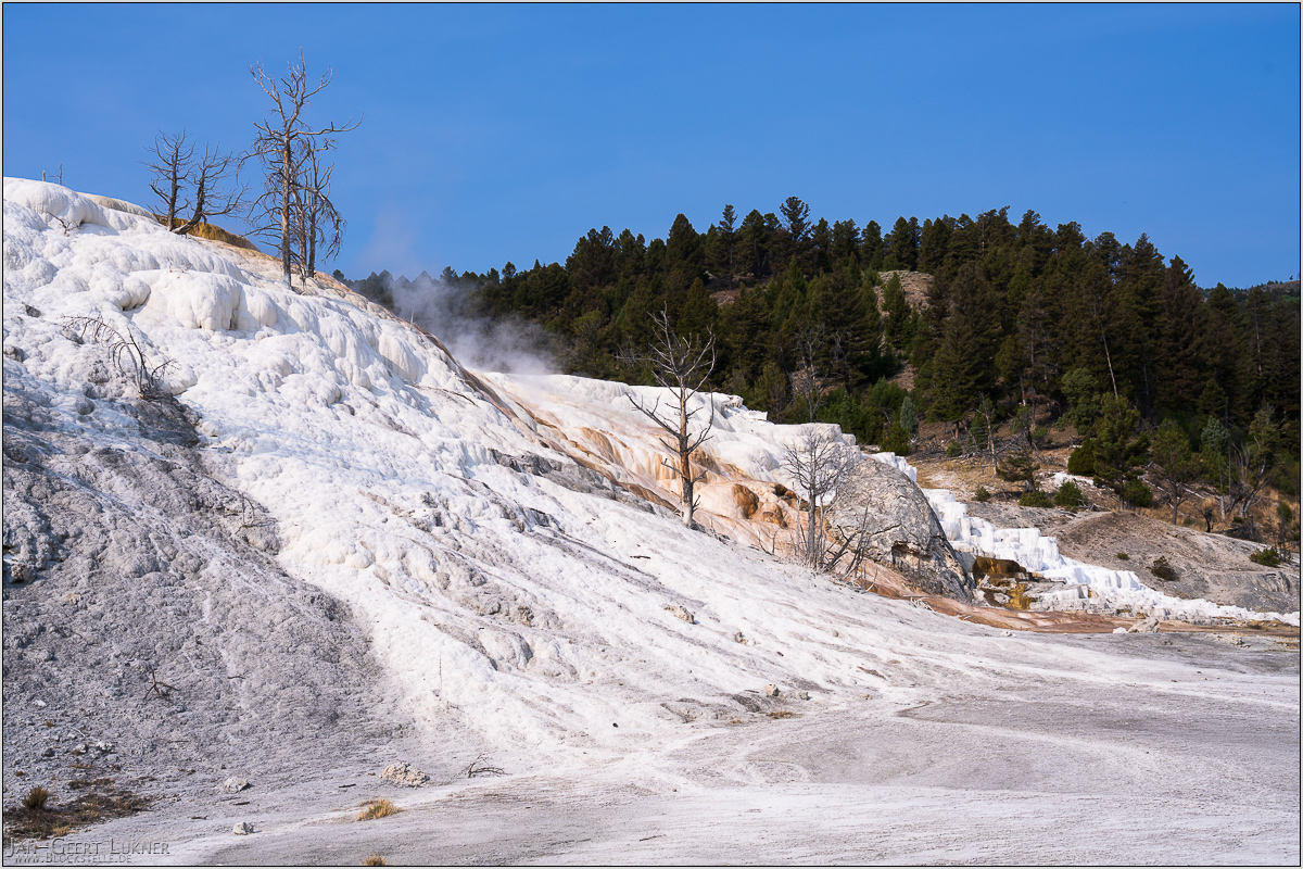
Bild 22. Aufnahmezeitpunkt/Recording time: 09.09.2025 um/at 10:10. Der ungefähre Fotostandpunkt auf/The approximate photo point on Google Maps. nächstes/next hoch/top
Kurzbeschreibung durch hinterlegte Stichwörter/Short description by included keywords:
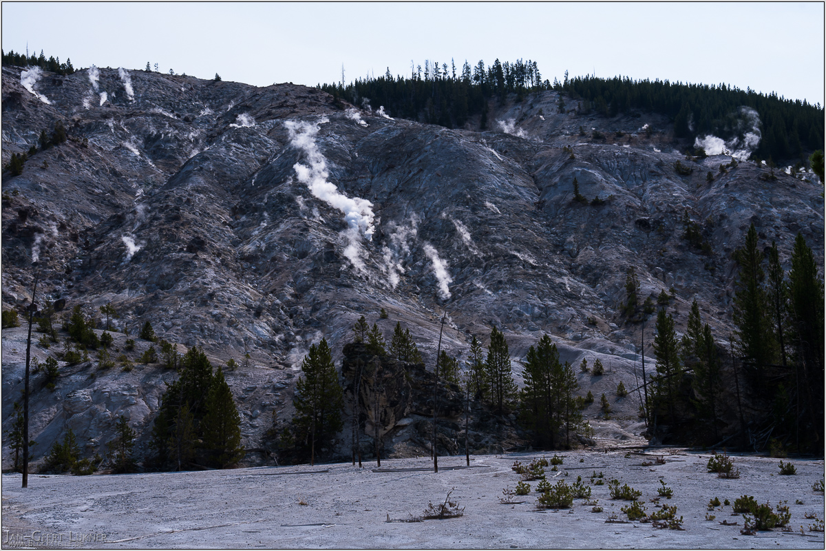
Bild 23. Aufnahmezeitpunkt/Recording time: 09.09.2025 um/at 11:07. Der ungefähre Fotostandpunkt auf/The approximate photo point on Google Maps. nächstes/next hoch/top
Kurzbeschreibung durch hinterlegte Stichwörter/Short description by included keywords:
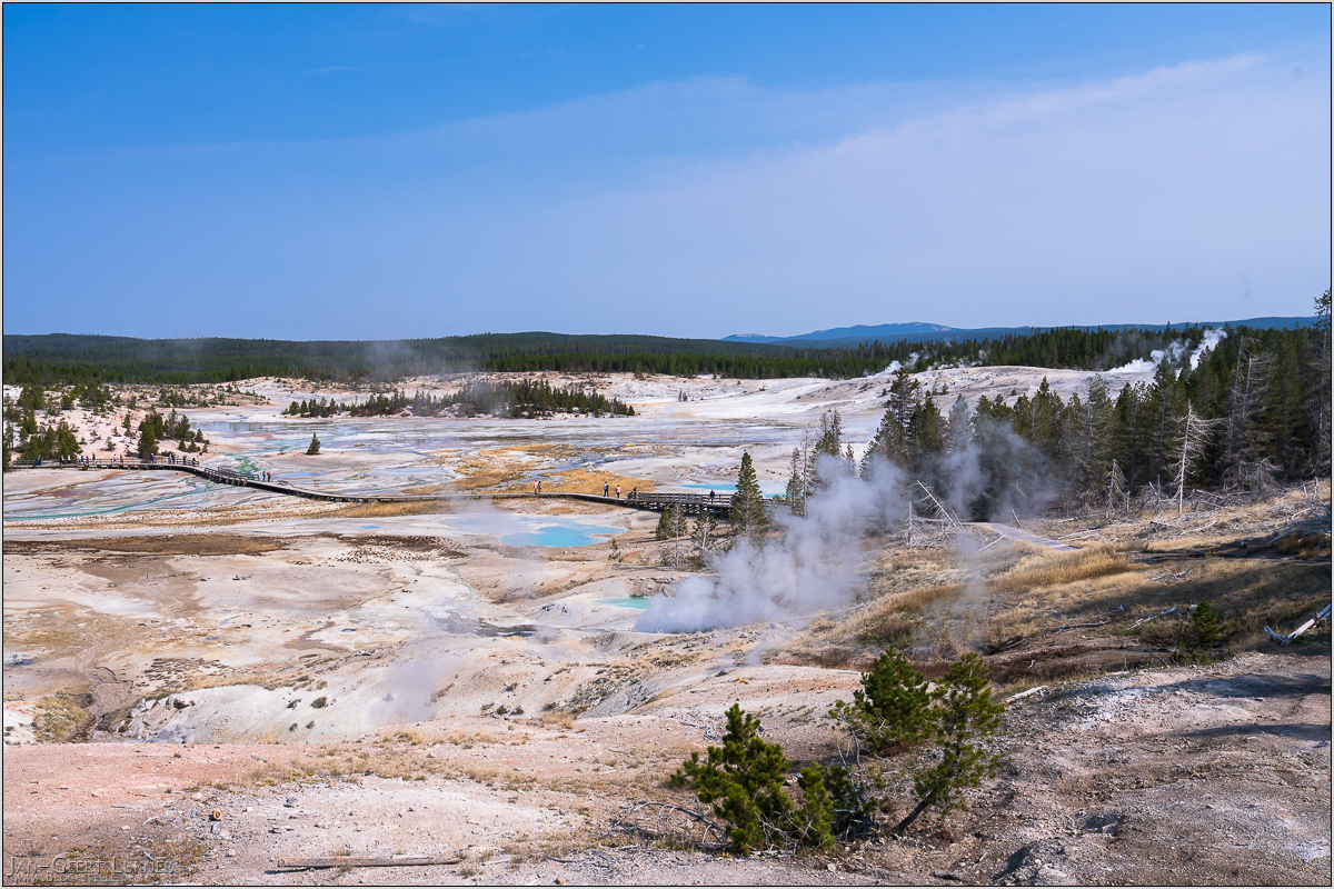
Bild 24. Aufnahmezeitpunkt/Recording time: 09.09.2025 um/at 11:35. Der ungefähre Fotostandpunkt auf/The approximate photo point on Google Maps. nächstes/next hoch/top
Kurzbeschreibung durch hinterlegte Stichwörter/Short description by included keywords:
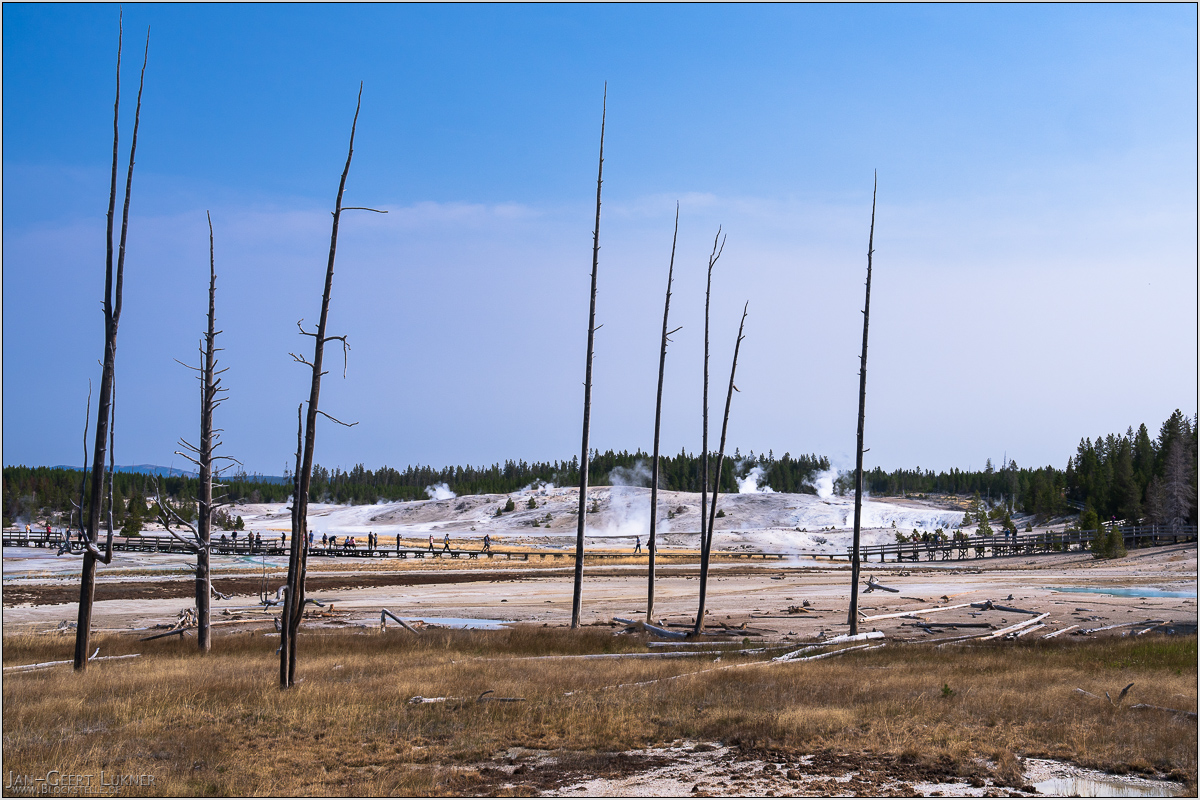
Bild 25. Aufnahmezeitpunkt/Recording time: 09.09.2025 um/at 11:39. Der ungefähre Fotostandpunkt auf/The approximate photo point on Google Maps. nächstes/next hoch/top
Kurzbeschreibung durch hinterlegte Stichwörter/Short description by included keywords:
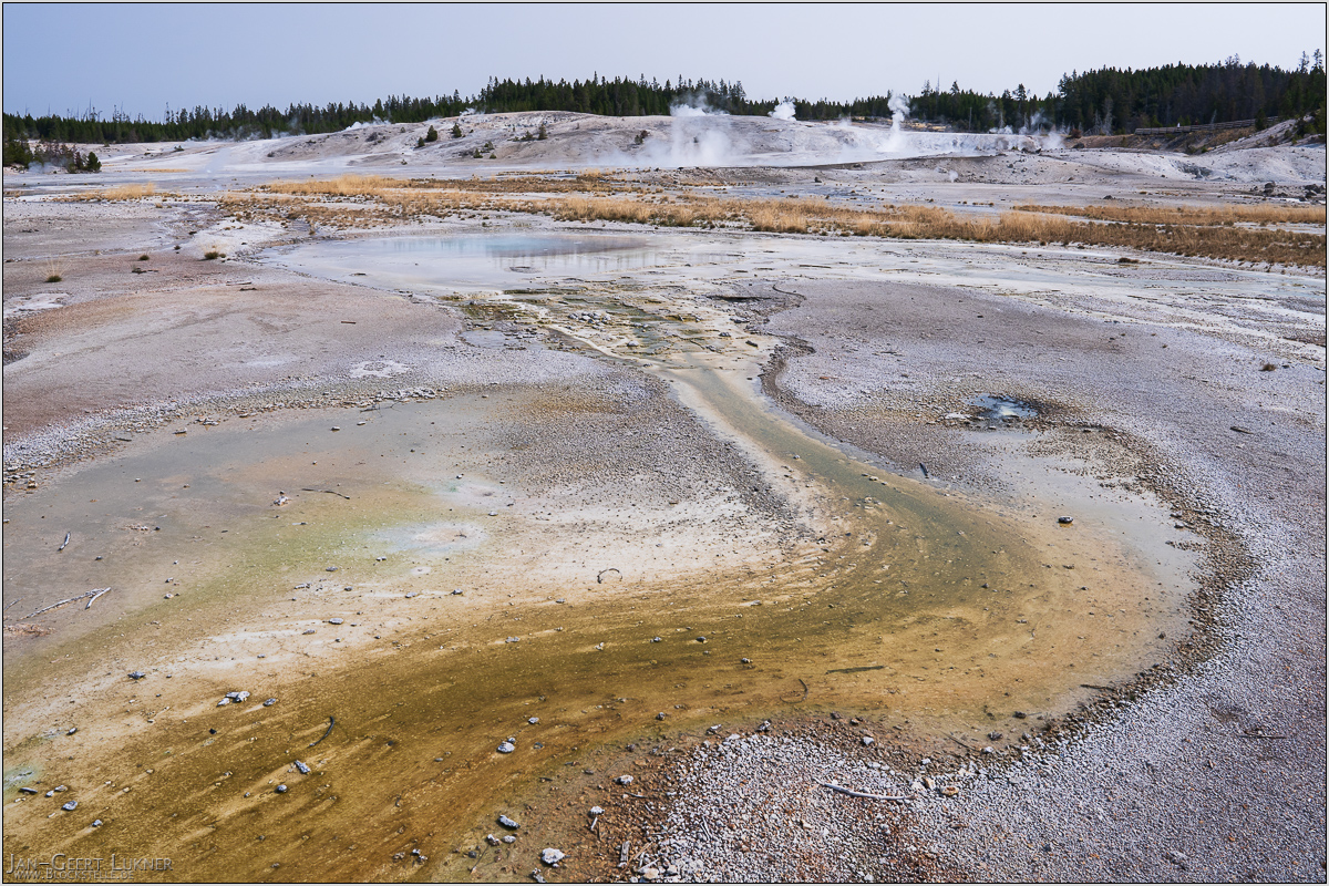
Bild 26. Aufnahmezeitpunkt/Recording time: 09.09.2025 um/at 11:45. Der ungefähre Fotostandpunkt auf/The approximate photo point on Google Maps. nächstes/next hoch/top
Kurzbeschreibung durch hinterlegte Stichwörter/Short description by included keywords:
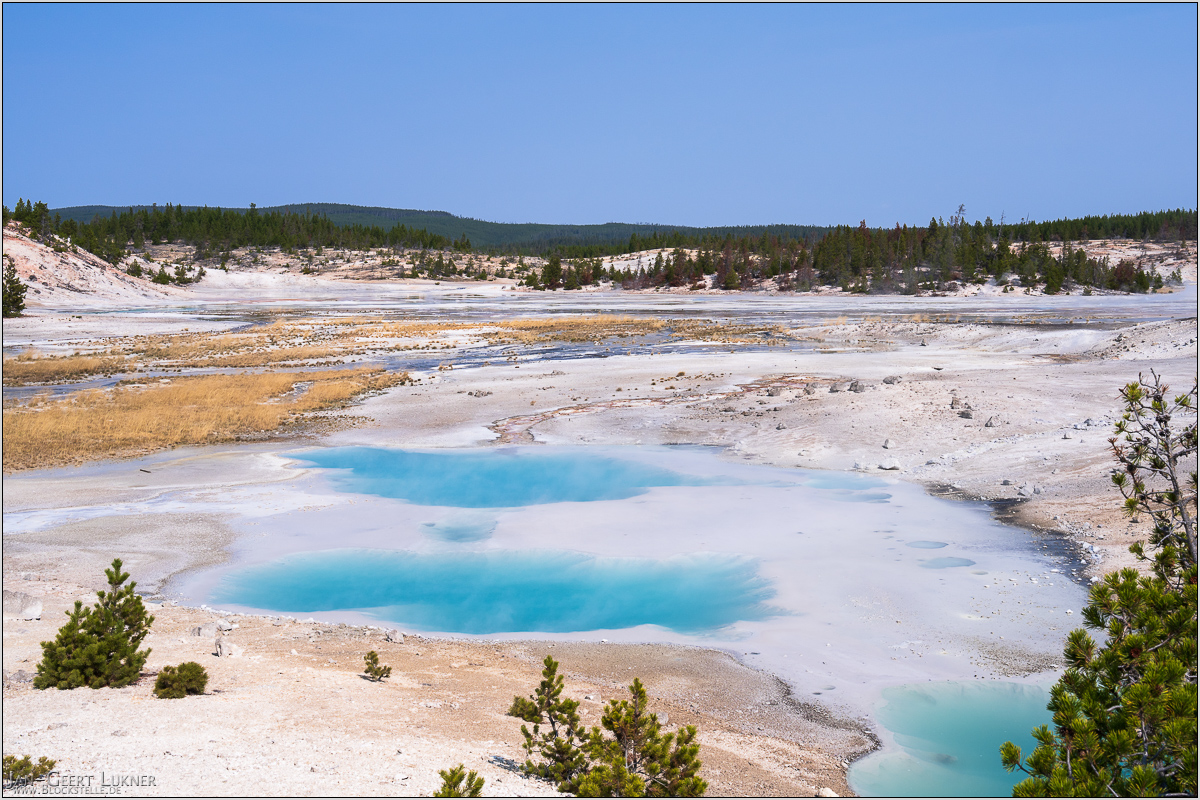
Bild 27. Aufnahmezeitpunkt/Recording time: 09.09.2025 um/at 11:48. Der ungefähre Fotostandpunkt auf/The approximate photo point on Google Maps. nächstes/next hoch/top
Kurzbeschreibung durch hinterlegte Stichwörter/Short description by included keywords:
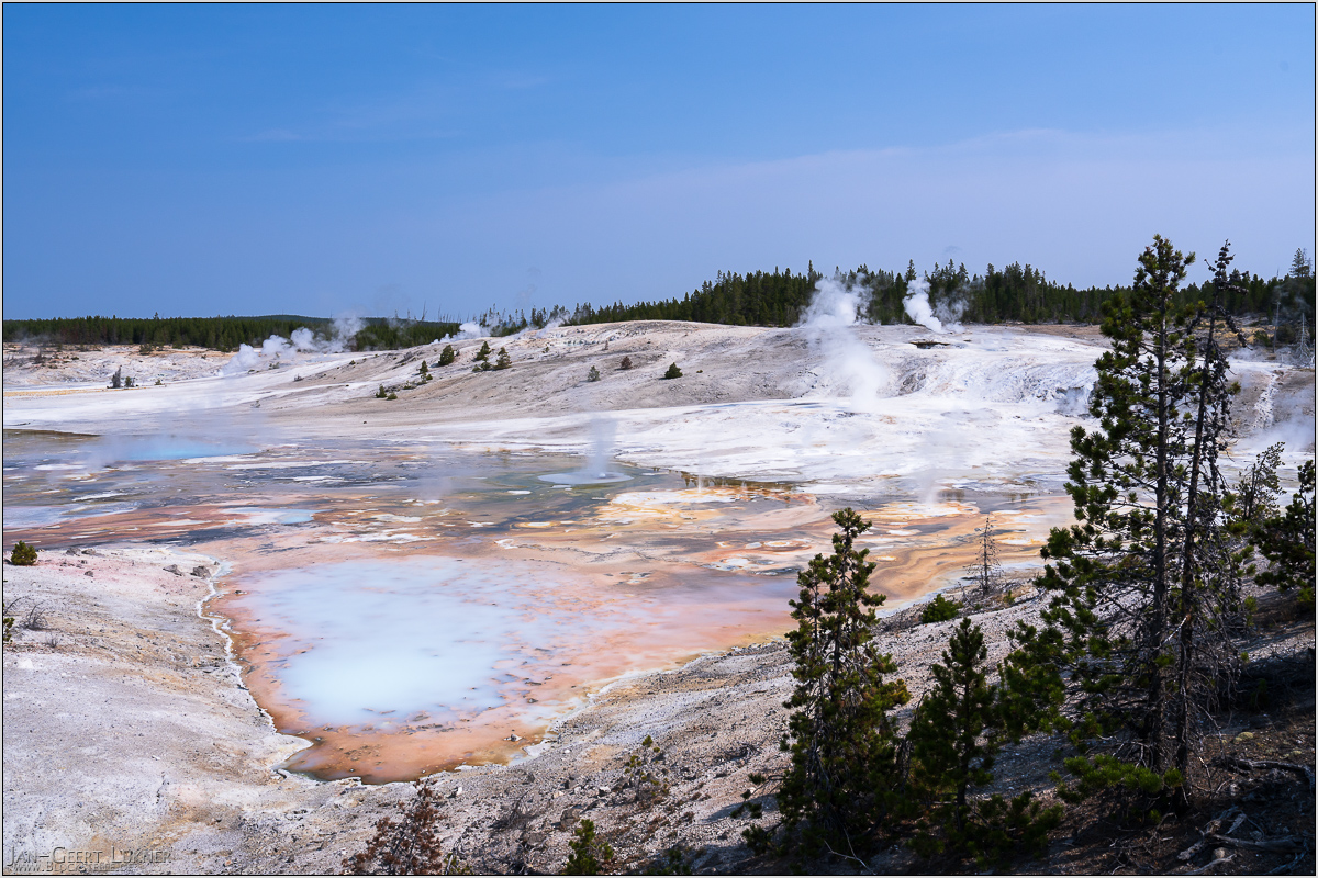
Bild 28. Aufnahmezeitpunkt/Recording time: 09.09.2025 um/at 11:51. Der ungefähre Fotostandpunkt auf/The approximate photo point on Google Maps. nächstes/next hoch/top
Kurzbeschreibung durch hinterlegte Stichwörter/Short description by included keywords:
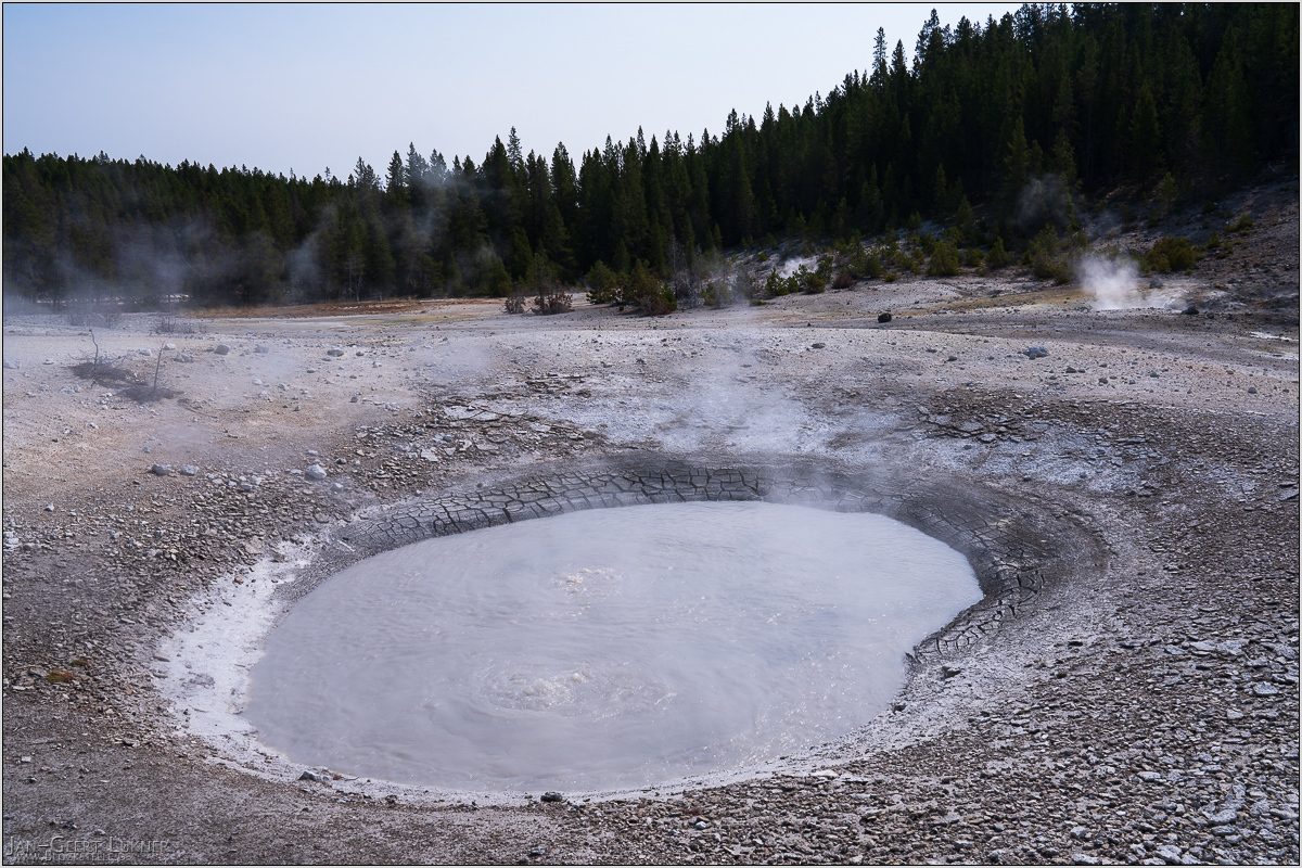
Bild 29. Aufnahmezeitpunkt/Recording time: 09.09.2025 um/at 11:54. Der ungefähre Fotostandpunkt auf/The approximate photo point on Google Maps. nächstes/next hoch/top
Kurzbeschreibung durch hinterlegte Stichwörter/Short description by included keywords:
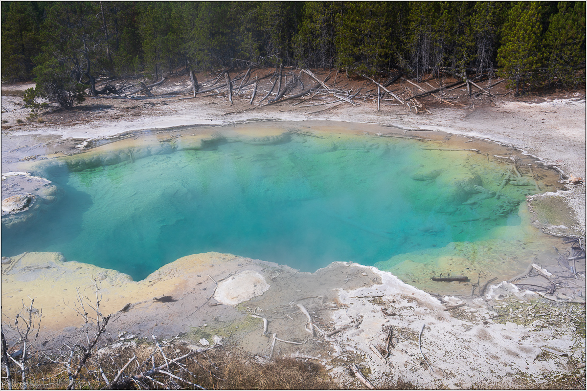
Bild 30. Aufnahmezeitpunkt/Recording time: 09.09.2025 um/at 11:59. Der ungefähre Fotostandpunkt auf/The approximate photo point on Google Maps. nächstes/next hoch/top
Kurzbeschreibung durch hinterlegte Stichwörter/Short description by included keywords:
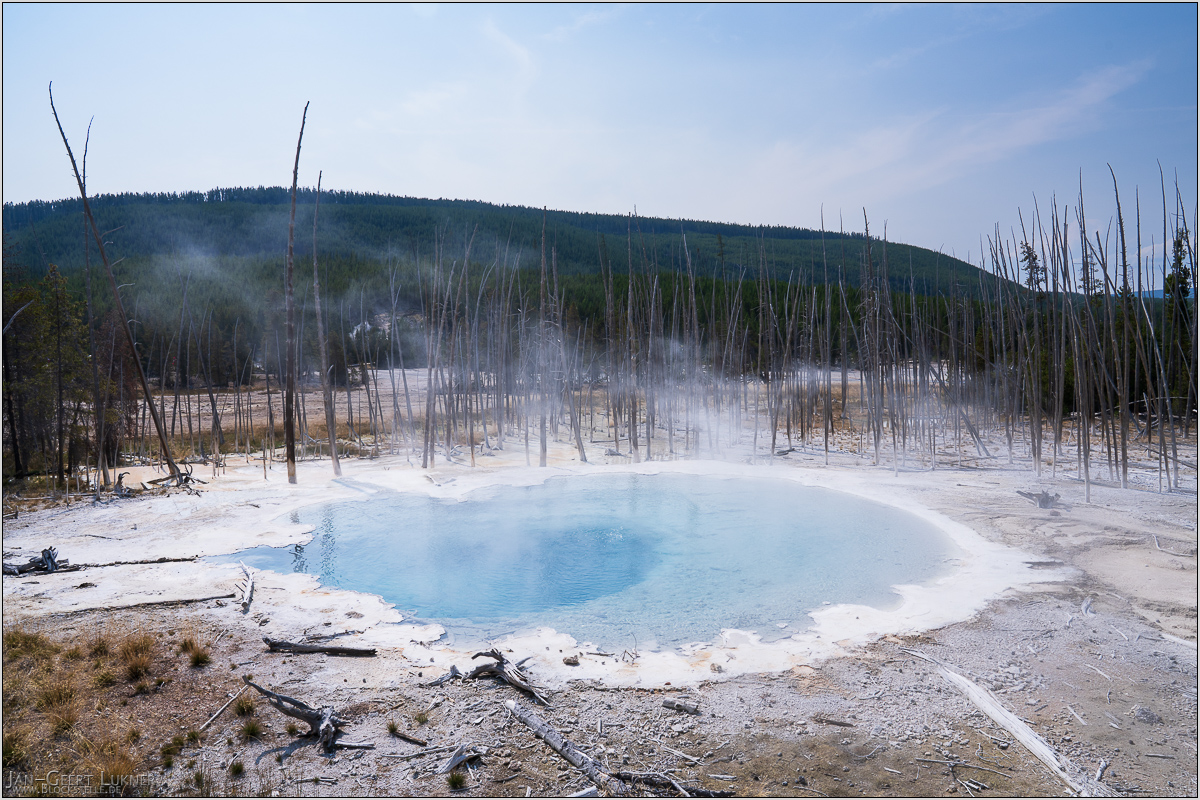
Bild 31. Aufnahmezeitpunkt/Recording time: 09.09.2025 um/at 12:09. Der ungefähre Fotostandpunkt auf/The approximate photo point on Google Maps. nächstes/next hoch/top
Kurzbeschreibung durch hinterlegte Stichwörter/Short description by included keywords:
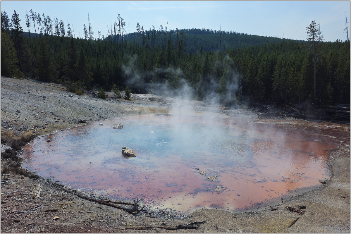
Bild 32. Aufnahmezeitpunkt/Recording time: 09.09.2025 um/at 12:16. Der ungefähre Fotostandpunkt auf/The approximate photo point on Google Maps. nächstes/next hoch/top
Kurzbeschreibung durch hinterlegte Stichwörter/Short description by included keywords:
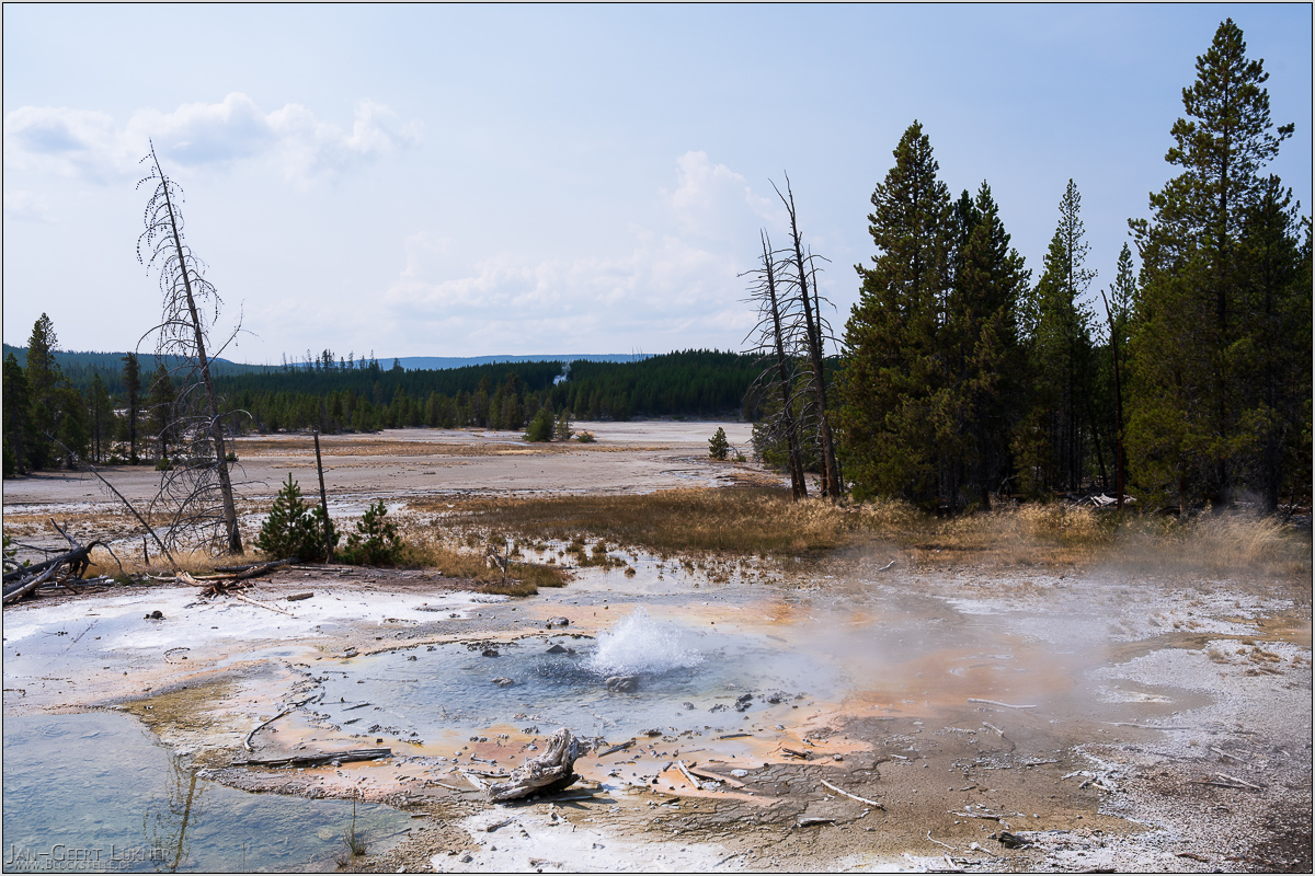
Bild 33. Aufnahmezeitpunkt/Recording time: 09.09.2025 um/at 12:40. Der ungefähre Fotostandpunkt auf/The approximate photo point on Google Maps. nächstes/next hoch/top
Kurzbeschreibung durch hinterlegte Stichwörter/Short description by included keywords:
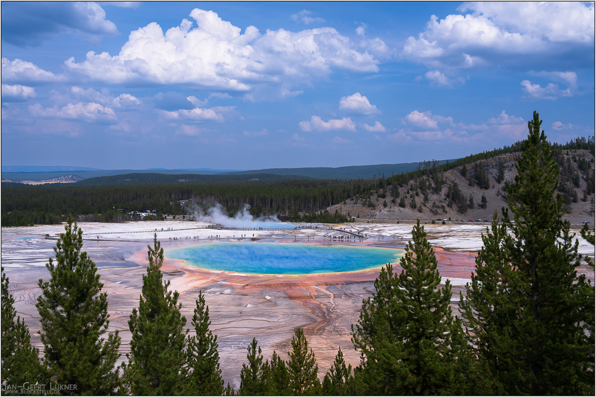
Bild 34. Aufnahmezeitpunkt/Recording time: 09.09.2025 um/at 14:31. Der ungefähre Fotostandpunkt auf/The approximate photo point on Google Maps. nächstes/next hoch/top
Kurzbeschreibung durch hinterlegte Stichwörter/Short description by included keywords:
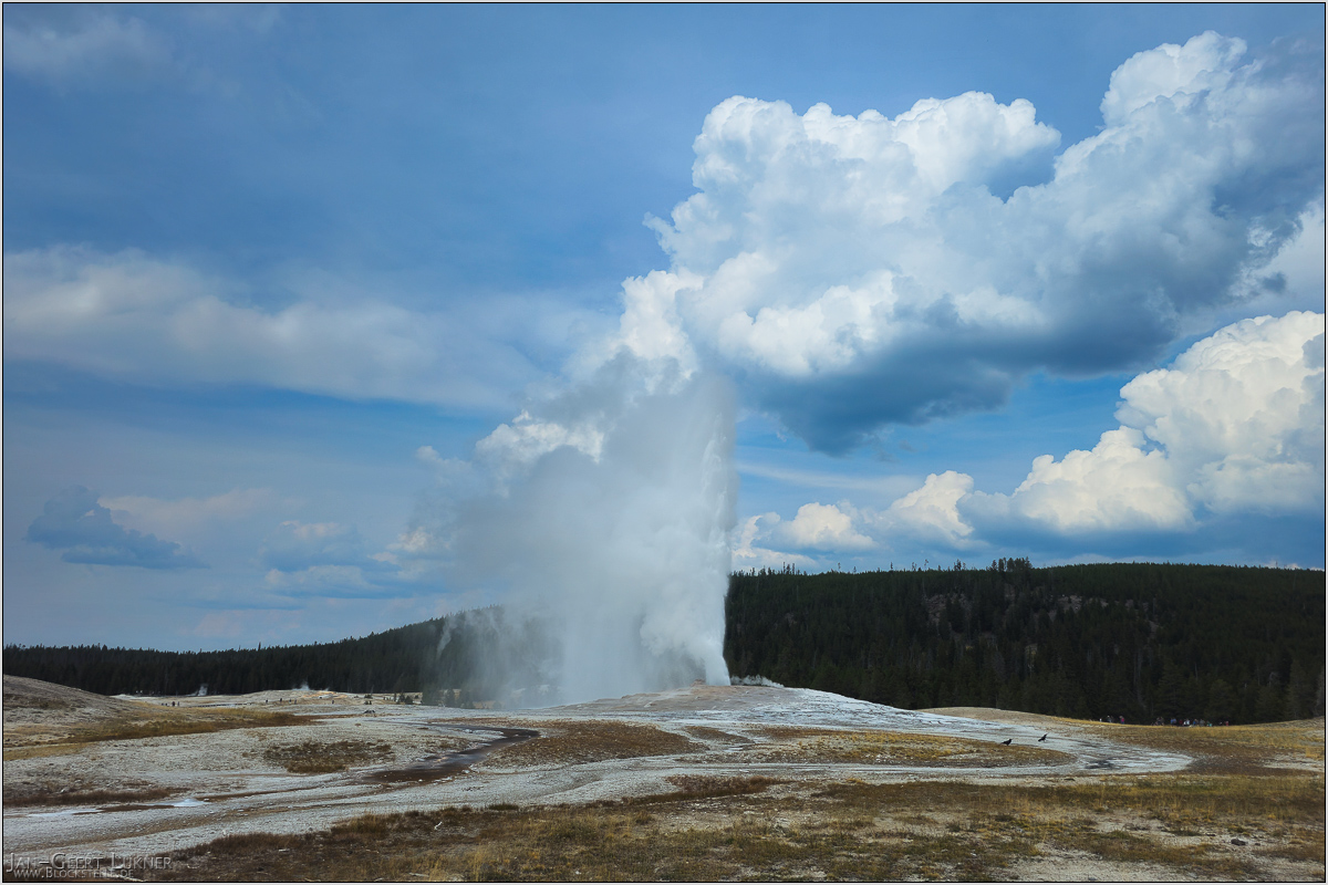
Bild 35. Aufnahmezeitpunkt/Recording time: 09.09.2025 um/at 15:18. Der ungefähre Fotostandpunkt auf/The approximate photo point on Google Maps. nächstes/next hoch/top
Kurzbeschreibung durch hinterlegte Stichwörter/Short description by included keywords:
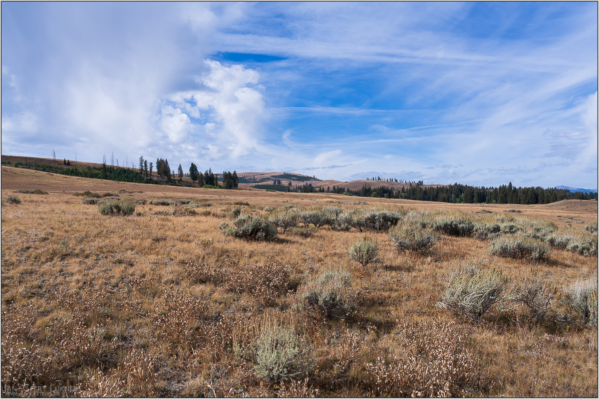
Bild 36. Aufnahmezeitpunkt/Recording time: 10.09.2025 um/at 10:36. Der ungefähre Fotostandpunkt auf/The approximate photo point on Google Maps. nächstes/next hoch/top
Kurzbeschreibung durch hinterlegte Stichwörter/Short description by included keywords:
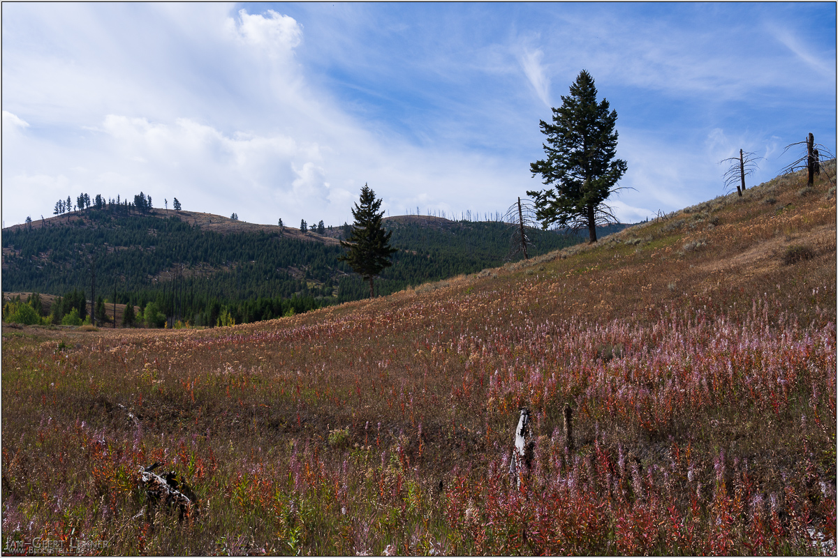
Bild 37. Aufnahmezeitpunkt/Recording time: 10.09.2025 um/at 10:59. Der ungefähre Fotostandpunkt auf/The approximate photo point on Google Maps. nächstes/next hoch/top
Kurzbeschreibung durch hinterlegte Stichwörter/Short description by included keywords:
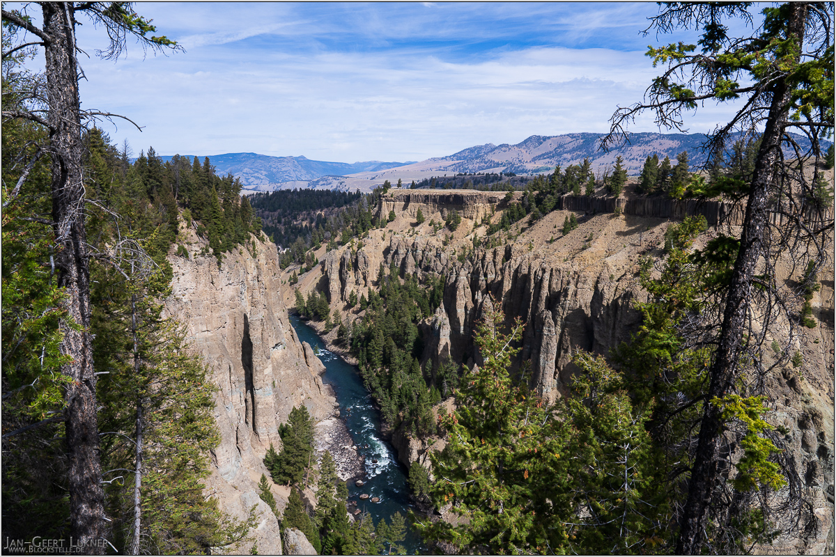
Bild 38. Aufnahmezeitpunkt/Recording time: 10.09.2025 um/at 11:32. Der ungefähre Fotostandpunkt auf/The approximate photo point on Google Maps. nächstes/next hoch/top
Kurzbeschreibung durch hinterlegte Stichwörter/Short description by included keywords:
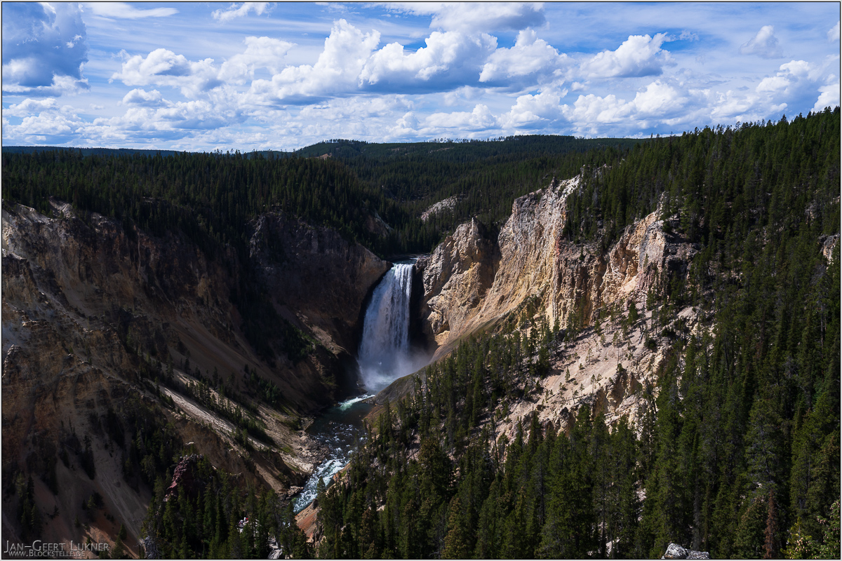
Bild 39. Aufnahmezeitpunkt/Recording time: 10.09.2025 um/at 13:00. Der ungefähre Fotostandpunkt auf/The approximate photo point on Google Maps. nächstes/next hoch/top
Kurzbeschreibung durch hinterlegte Stichwörter/Short description by included keywords:
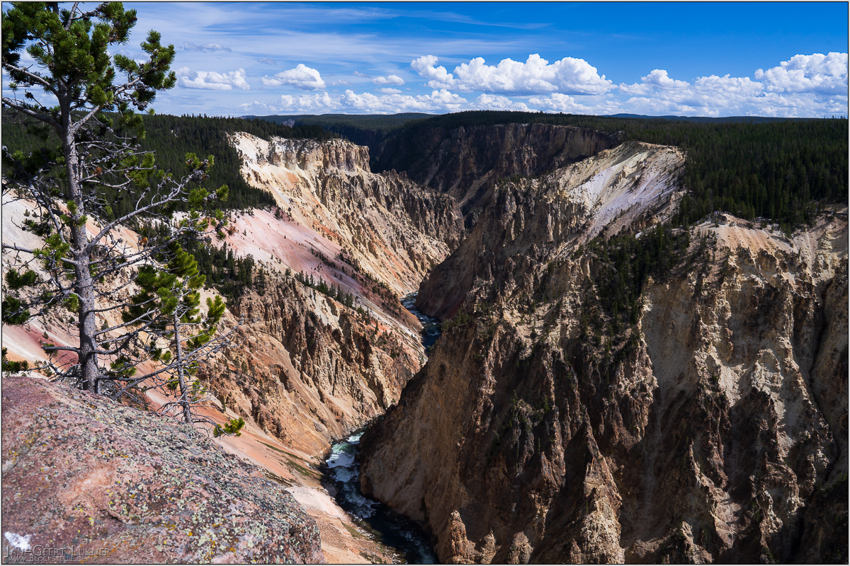
Bild 40. Aufnahmezeitpunkt/Recording time: 10.09.2025 um/at 13:20. Der ungefähre Fotostandpunkt auf/The approximate photo point on Google Maps. nächstes/next hoch/top
Kurzbeschreibung durch hinterlegte Stichwörter/Short description by included keywords:
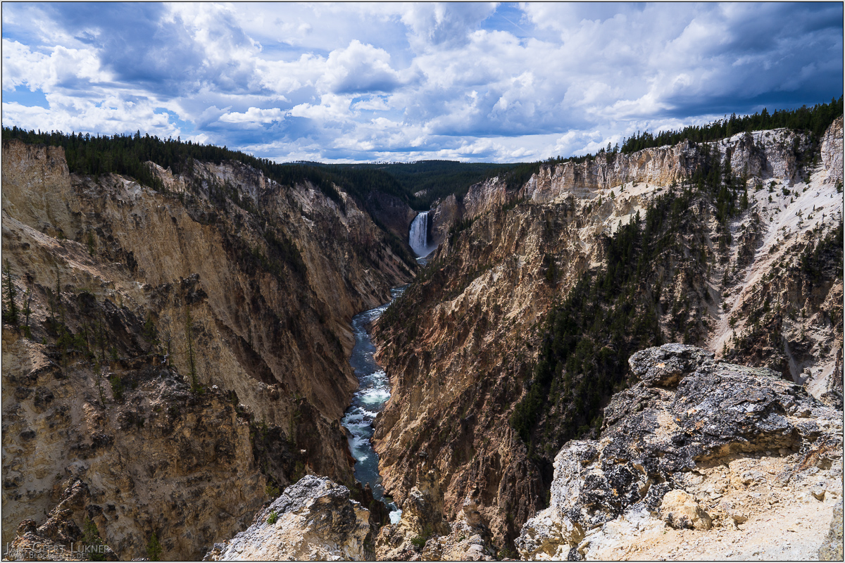
Bild 41. Aufnahmezeitpunkt/Recording time: 10.09.2025 um/at 13:57. Der ungefähre Fotostandpunkt auf/The approximate photo point on Google Maps. nächstes/next hoch/top
Kurzbeschreibung durch hinterlegte Stichwörter/Short description by included keywords:
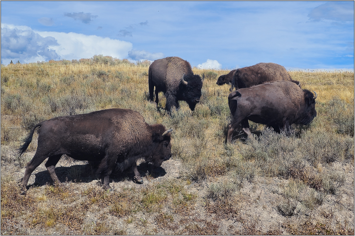
Bild 42. Aufnahmezeitpunkt/Recording time: 10.09.2025 um/at 14:30. Der ungefähre Fotostandpunkt auf/The approximate photo point on Google Maps. nächstes/next hoch/top
Kurzbeschreibung durch hinterlegte Stichwörter/Short description by included keywords:
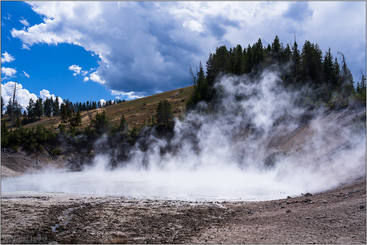
Bild 43. Aufnahmezeitpunkt/Recording time: 10.09.2025 um/at 14:43. Der ungefähre Fotostandpunkt auf/The approximate photo point on Google Maps. nächstes/next hoch/top
Kurzbeschreibung durch hinterlegte Stichwörter/Short description by included keywords:
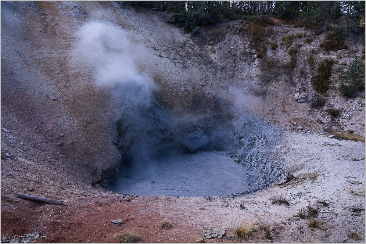
Bild 44. Aufnahmezeitpunkt/Recording time: 10.09.2025 um/at 14:46. Der ungefähre Fotostandpunkt auf/The approximate photo point on Google Maps. nächstes/next hoch/top
Kurzbeschreibung durch hinterlegte Stichwörter/Short description by included keywords:
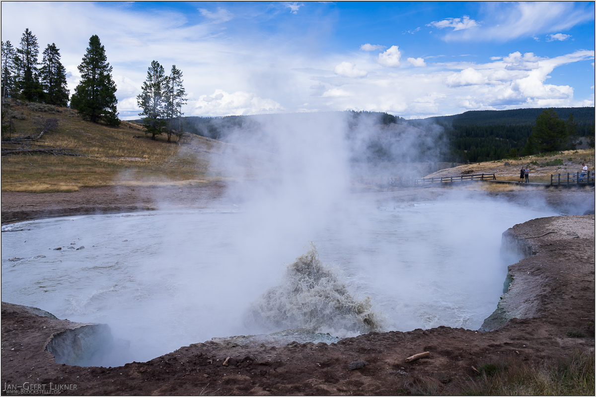
Bild 45. Aufnahmezeitpunkt/Recording time: 10.09.2025 um/at 15:01. Der ungefähre Fotostandpunkt auf/The approximate photo point on Google Maps. nächstes/next hoch/top
Kurzbeschreibung durch hinterlegte Stichwörter/Short description by included keywords:
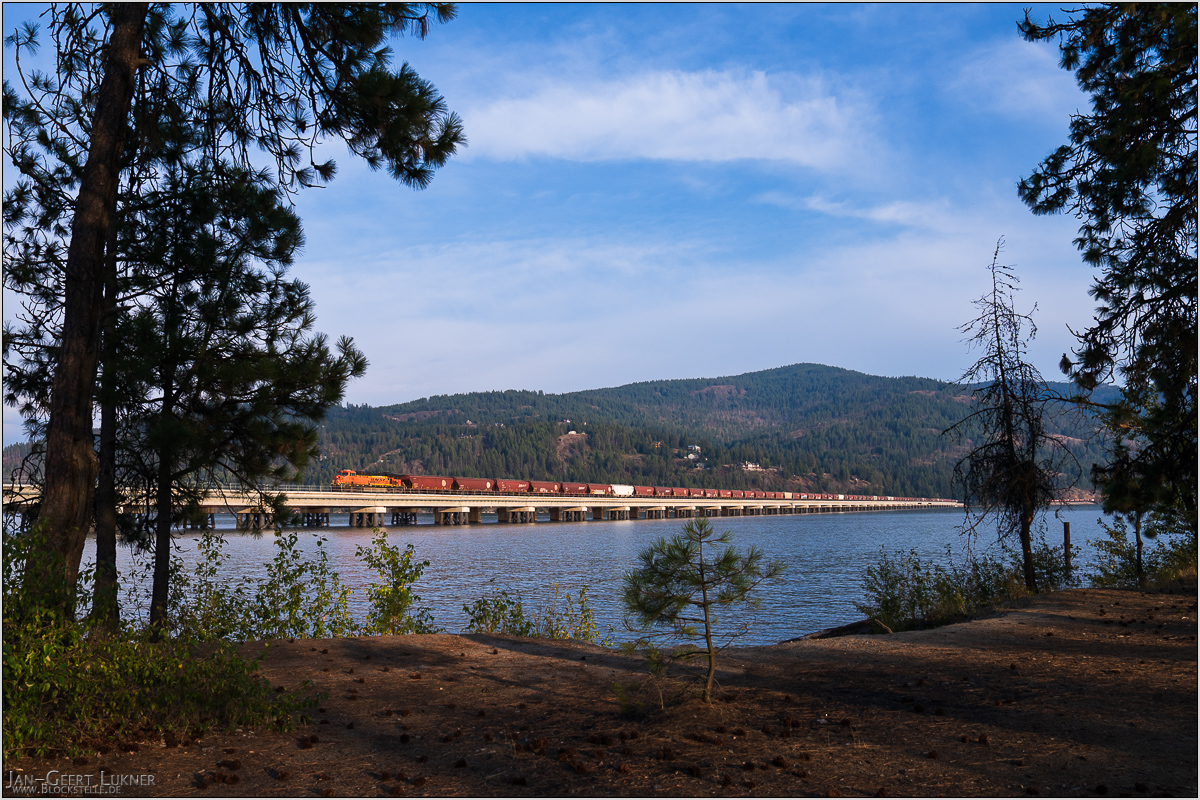
Bild 46. Aufnahmezeitpunkt/Recording time: 11.09.2025 um/at 17:45. Der ungefähre Fotostandpunkt auf/The approximate photo point on Google Maps. nächstes/next hoch/top
Kurzbeschreibung durch hinterlegte Stichwörter/Short description by included keywords:
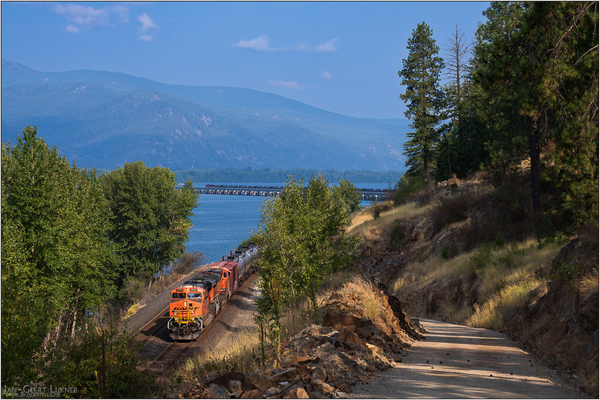
Bild 47. Aufnahmezeitpunkt/Recording time: 12.09.2025 um/at 10:11. Der ungefähre Fotostandpunkt auf/The approximate photo point on Google Maps. nächstes/next hoch/top
Kurzbeschreibung durch hinterlegte Stichwörter/Short description by included keywords:
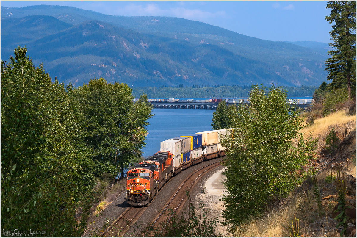
Bild 48. Aufnahmezeitpunkt/Recording time: 12.09.2025 um/at 10:58. Der ungefähre Fotostandpunkt auf/The approximate photo point on Google Maps. nächstes/next hoch/top
Kurzbeschreibung durch hinterlegte Stichwörter/Short description by included keywords:
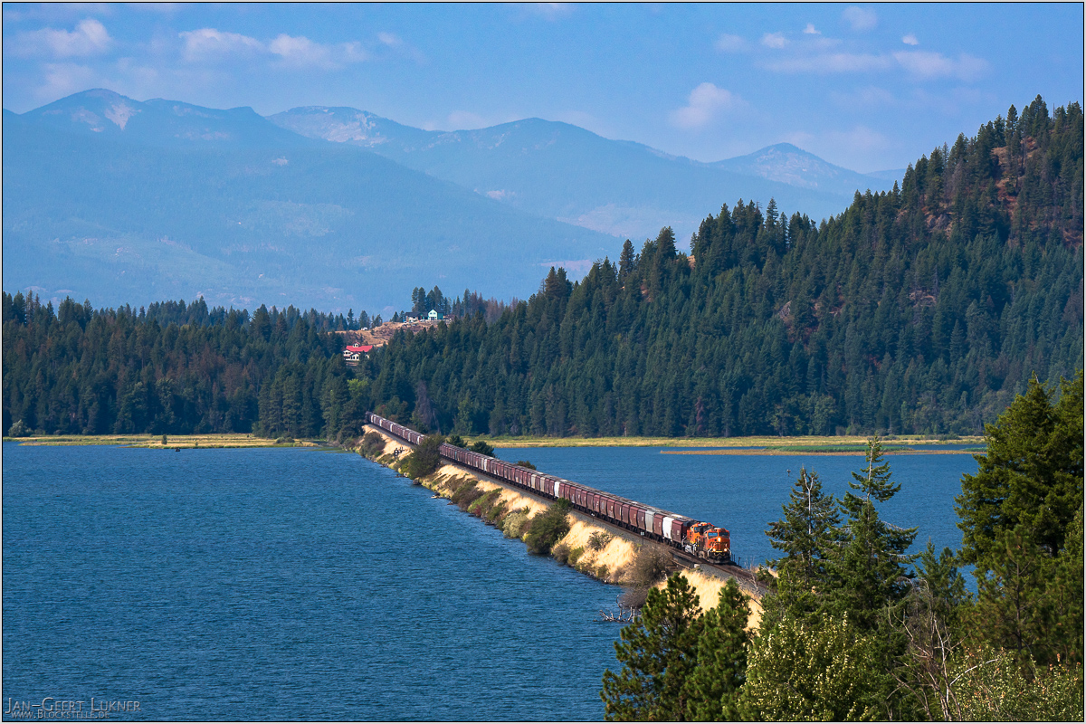
Bild 49. Aufnahmezeitpunkt/Recording time: 12.09.2025 um/at 12:41. Der ungefähre Fotostandpunkt auf/The approximate photo point on Google Maps. nächstes/next hoch/top
Kurzbeschreibung durch hinterlegte Stichwörter/Short description by included keywords:
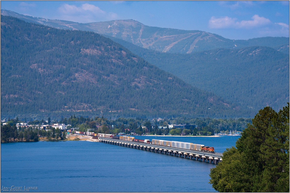
Bild 50. Aufnahmezeitpunkt/Recording time: 12.09.2025 um/at 13:25. Der ungefähre Fotostandpunkt auf/The approximate photo point on Google Maps. nächstes/next hoch/top
Kurzbeschreibung durch hinterlegte Stichwörter/Short description by included keywords:
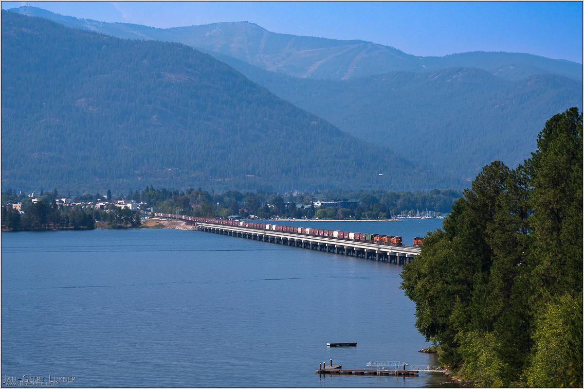
Bild 51. Aufnahmezeitpunkt/Recording time: 12.09.2025 um/at 15:23. Der ungefähre Fotostandpunkt auf/The approximate photo point on Google Maps. nächstes/next hoch/top
Kurzbeschreibung durch hinterlegte Stichwörter/Short description by included keywords:
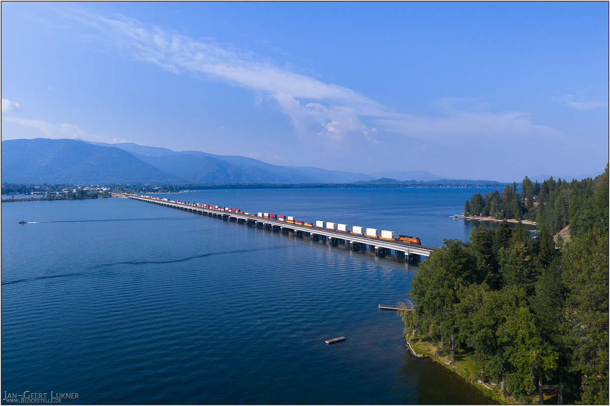
Bild 52. Aufnahmezeitpunkt/Recording time: 12.09.2025 um/at 15:32. Der ungefähre Fotostandpunkt auf/The approximate photo point on Google Maps. nächstes/next hoch/top
Kurzbeschreibung durch hinterlegte Stichwörter/Short description by included keywords:
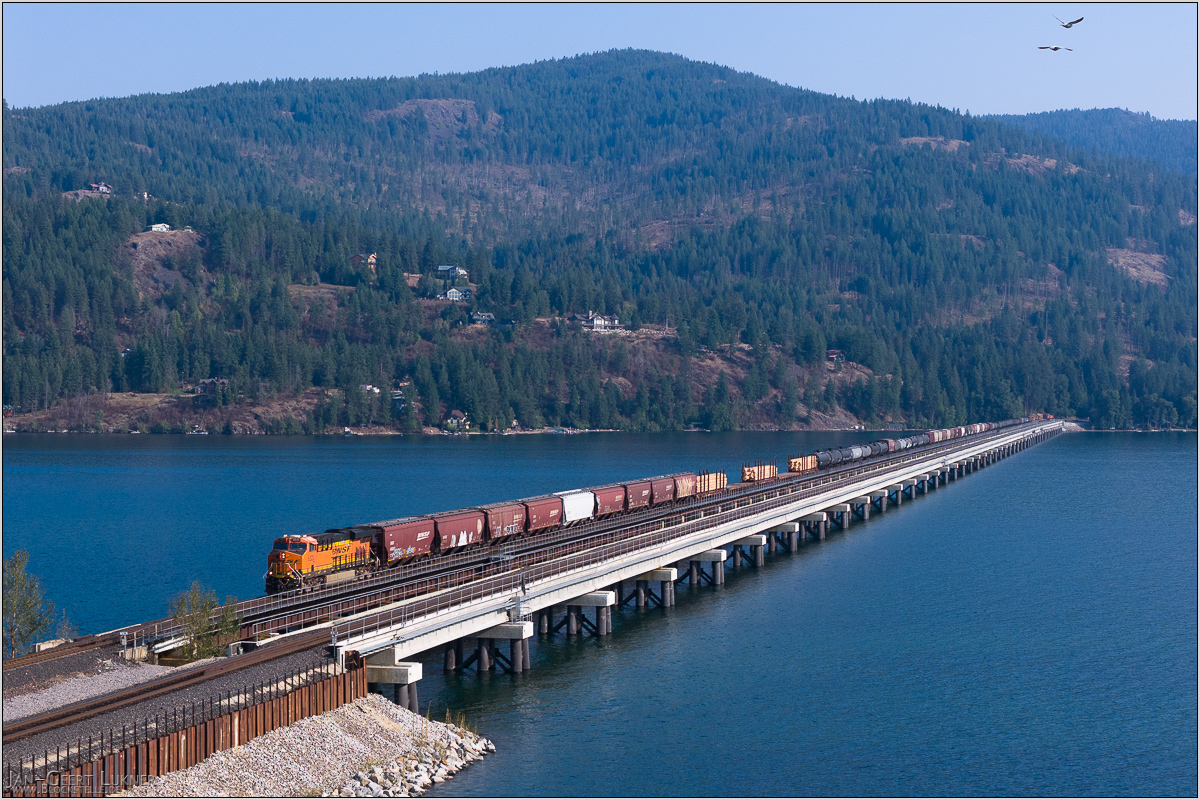
Bild 53. Aufnahmezeitpunkt/Recording time: 12.09.2025 um/at 16:09. Der ungefähre Fotostandpunkt auf/The approximate photo point on Google Maps. nächstes/next hoch/top
Kurzbeschreibung durch hinterlegte Stichwörter/Short description by included keywords:
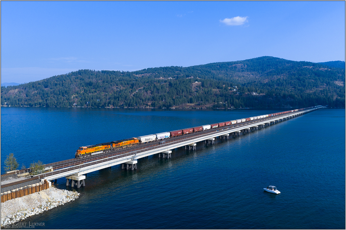
Bild 54. Aufnahmezeitpunkt/Recording time: 12.09.2025 um/at 16:39. Der ungefähre Fotostandpunkt auf/The approximate photo point on Google Maps. nächstes/next hoch/top
Kurzbeschreibung durch hinterlegte Stichwörter/Short description by included keywords:
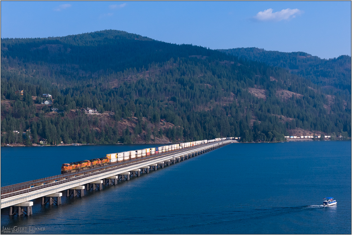
Bild 55. Aufnahmezeitpunkt/Recording time: 12.09.2025 um/at 17:05. Der ungefähre Fotostandpunkt auf/The approximate photo point on Google Maps. nächstes/next hoch/top
Kurzbeschreibung durch hinterlegte Stichwörter/Short description by included keywords:
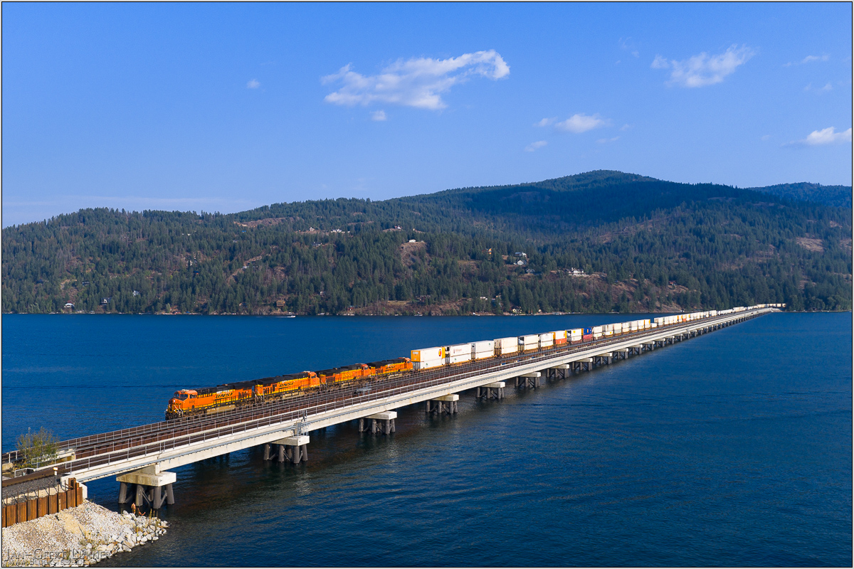
Bild 56. Aufnahmezeitpunkt/Recording time: 12.09.2025 um/at 17:05. Der ungefähre Fotostandpunkt auf/The approximate photo point on Google Maps. nächstes/next hoch/top
Kurzbeschreibung durch hinterlegte Stichwörter/Short description by included keywords:
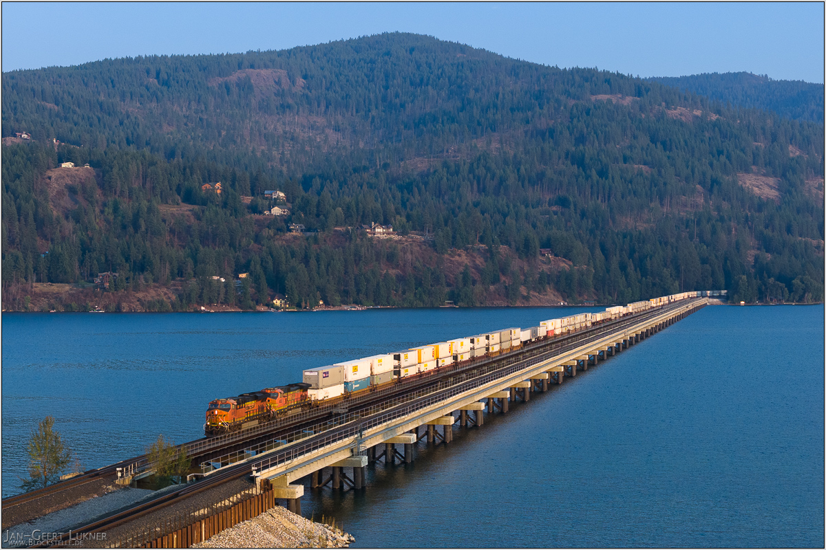
Bild 57. Aufnahmezeitpunkt/Recording time: 12.09.2025 um/at 18:18. Der ungefähre Fotostandpunkt auf/The approximate photo point on Google Maps. nächstes/next hoch/top
Kurzbeschreibung durch hinterlegte Stichwörter/Short description by included keywords:
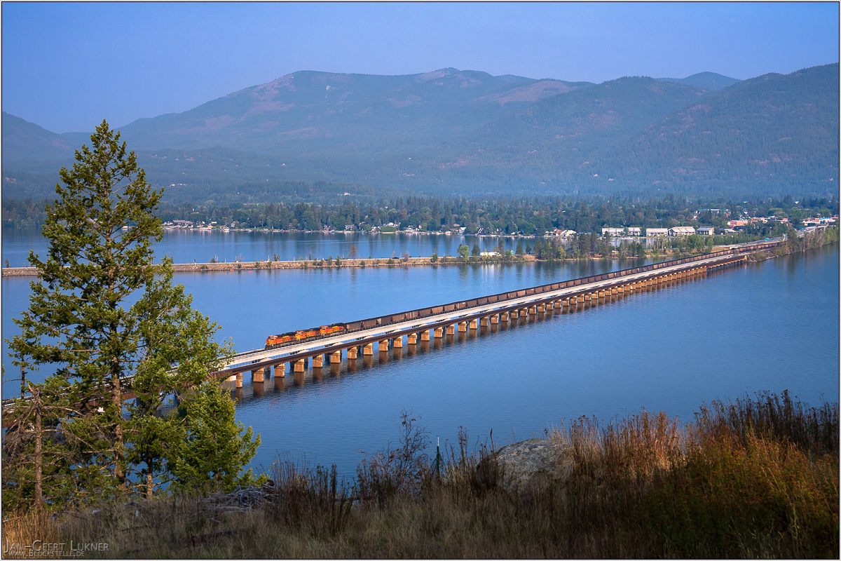
Bild 58. Aufnahmezeitpunkt/Recording time: 13.09.2025 um/at 08:36. Der ungefähre Fotostandpunkt auf/The approximate photo point on Google Maps. nächstes/next hoch/top
Kurzbeschreibung durch hinterlegte Stichwörter/Short description by included keywords:
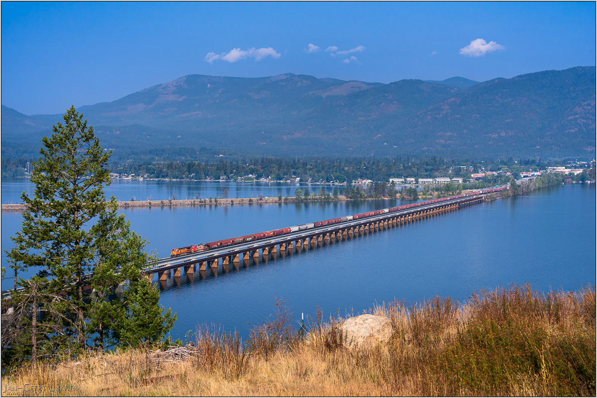
Bild 59. Aufnahmezeitpunkt/Recording time: 13.09.2025 um/at 09:36. Der ungefähre Fotostandpunkt auf/The approximate photo point on Google Maps. nächstes/next hoch/top
Kurzbeschreibung durch hinterlegte Stichwörter/Short description by included keywords:
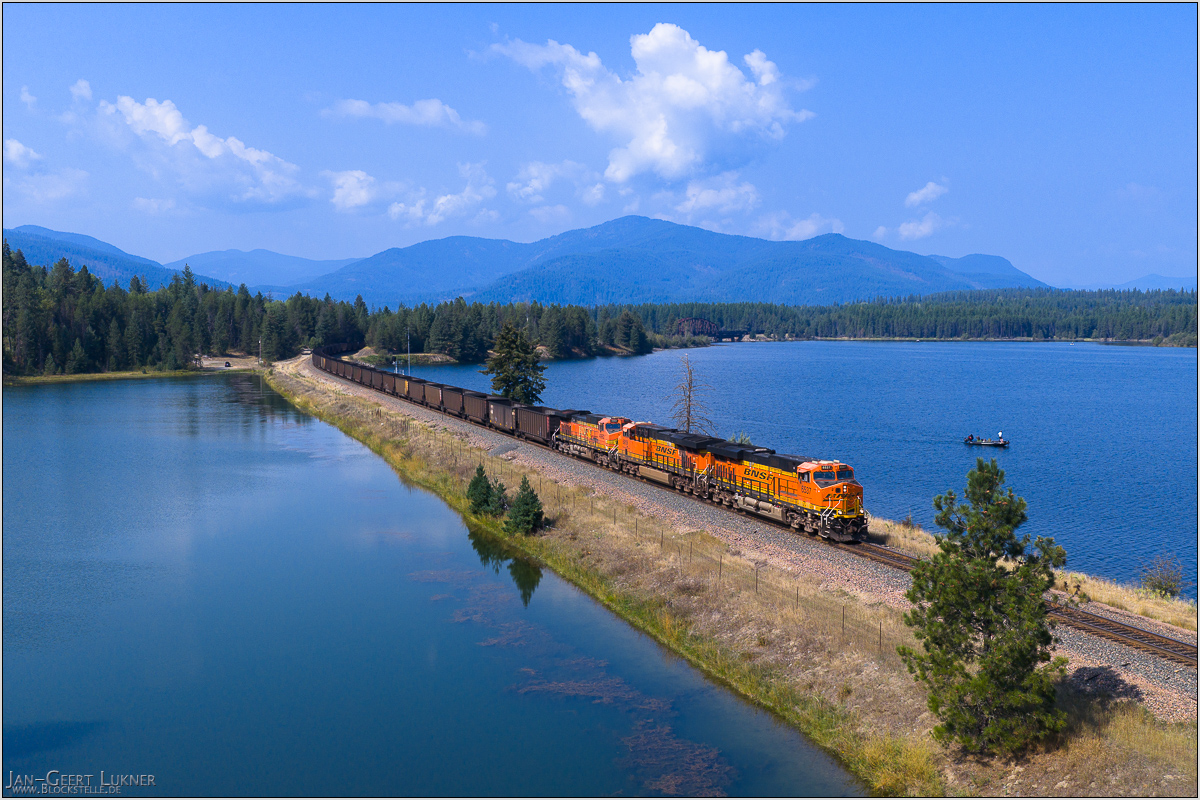
Bild 60. Aufnahmezeitpunkt/Recording time: 13.09.2025 um/at 12:16. Der ungefähre Fotostandpunkt auf/The approximate photo point on Google Maps. nächstes/next hoch/top
Kurzbeschreibung durch hinterlegte Stichwörter/Short description by included keywords:
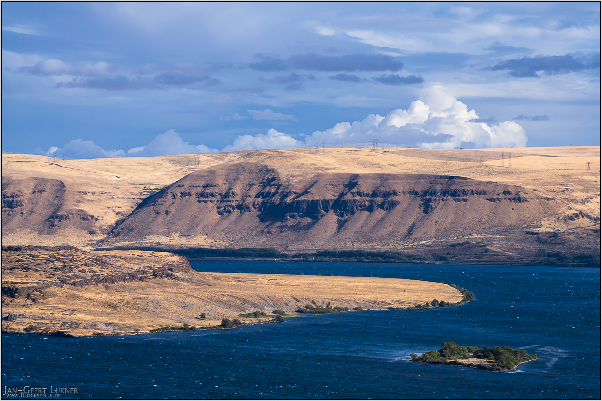
Bild 61. Aufnahmezeitpunkt/Recording time: 14.09.2025 um/at 16:42. Der ungefähre Fotostandpunkt auf/The approximate photo point on Google Maps. nächstes/next hoch/top
Kurzbeschreibung durch hinterlegte Stichwörter/Short description by included keywords:
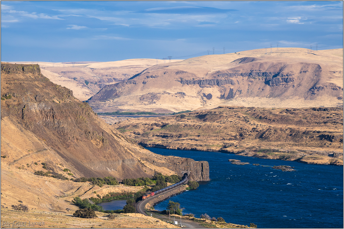
Bild 62. Aufnahmezeitpunkt/Recording time: 14.09.2025 um/at 17:38. Der ungefähre Fotostandpunkt auf/The approximate photo point on Google Maps. nächstes/next hoch/top
Kurzbeschreibung durch hinterlegte Stichwörter/Short description by included keywords:
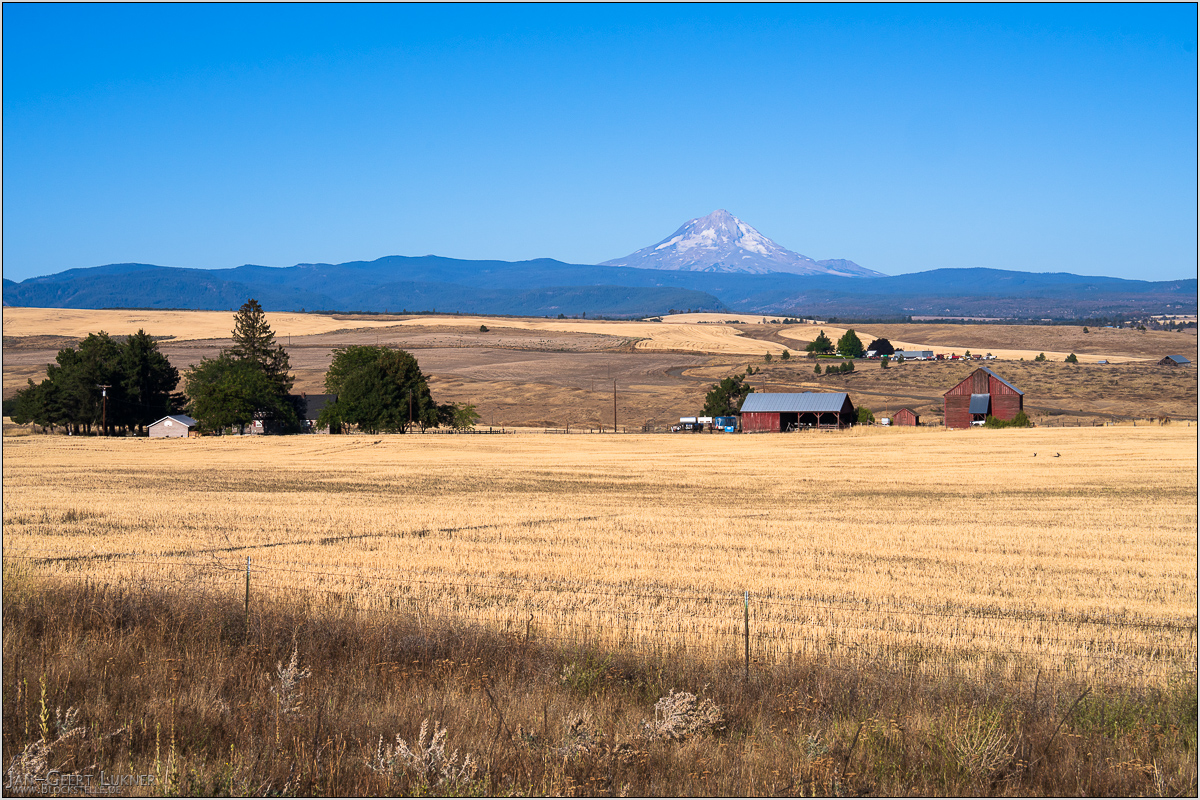
Bild 63. Aufnahmezeitpunkt/Recording time: 15.09.2025 um/at 08:32. Der ungefähre Fotostandpunkt auf/The approximate photo point on Google Maps. nächstes/next hoch/top
Kurzbeschreibung durch hinterlegte Stichwörter/Short description by included keywords:
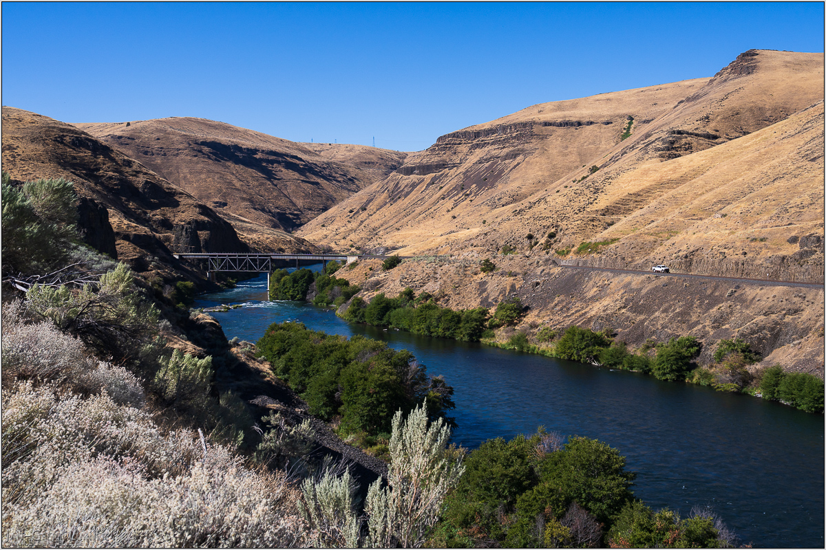
Bild 64. Aufnahmezeitpunkt/Recording time: 15.09.2025 um/at 10:45. Der ungefähre Fotostandpunkt auf/The approximate photo point on Google Maps. nächstes/next hoch/top
Kurzbeschreibung durch hinterlegte Stichwörter/Short description by included keywords:
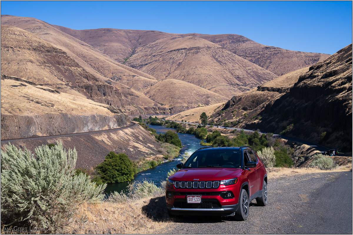
Bild 65. Aufnahmezeitpunkt/Recording time: 15.09.2025 um/at 11:14. Der ungefähre Fotostandpunkt auf/The approximate photo point on Google Maps. nächstes/next hoch/top
Kurzbeschreibung durch hinterlegte Stichwörter/Short description by included keywords:
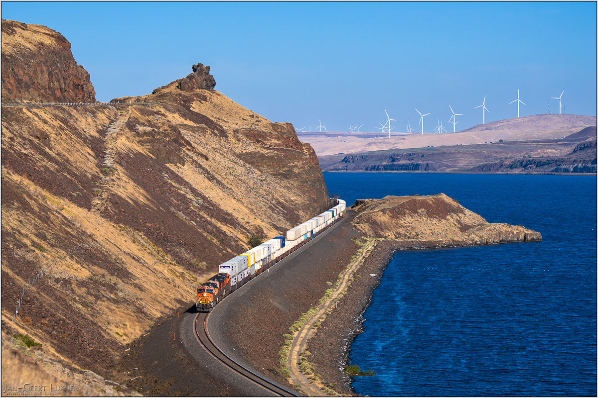
Bild 66. Aufnahmezeitpunkt/Recording time: 15.09.2025 um/at 16:59. Der ungefähre Fotostandpunkt auf/The approximate photo point on Google Maps. nächstes/next hoch/top
Kurzbeschreibung durch hinterlegte Stichwörter/Short description by included keywords:
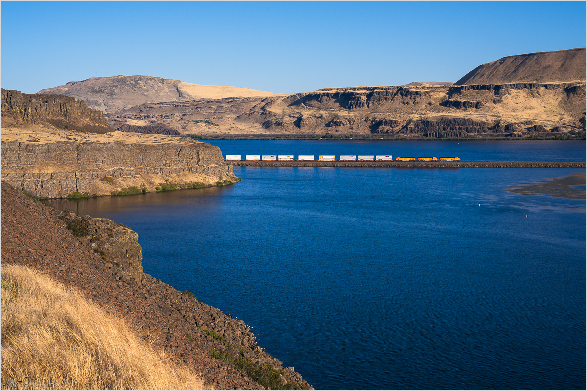
Bild 67. Aufnahmezeitpunkt/Recording time: 15.09.2025 um/at 17:42. Der ungefähre Fotostandpunkt auf/The approximate photo point on Google Maps. nächstes/next hoch/top
Kurzbeschreibung durch hinterlegte Stichwörter/Short description by included keywords:
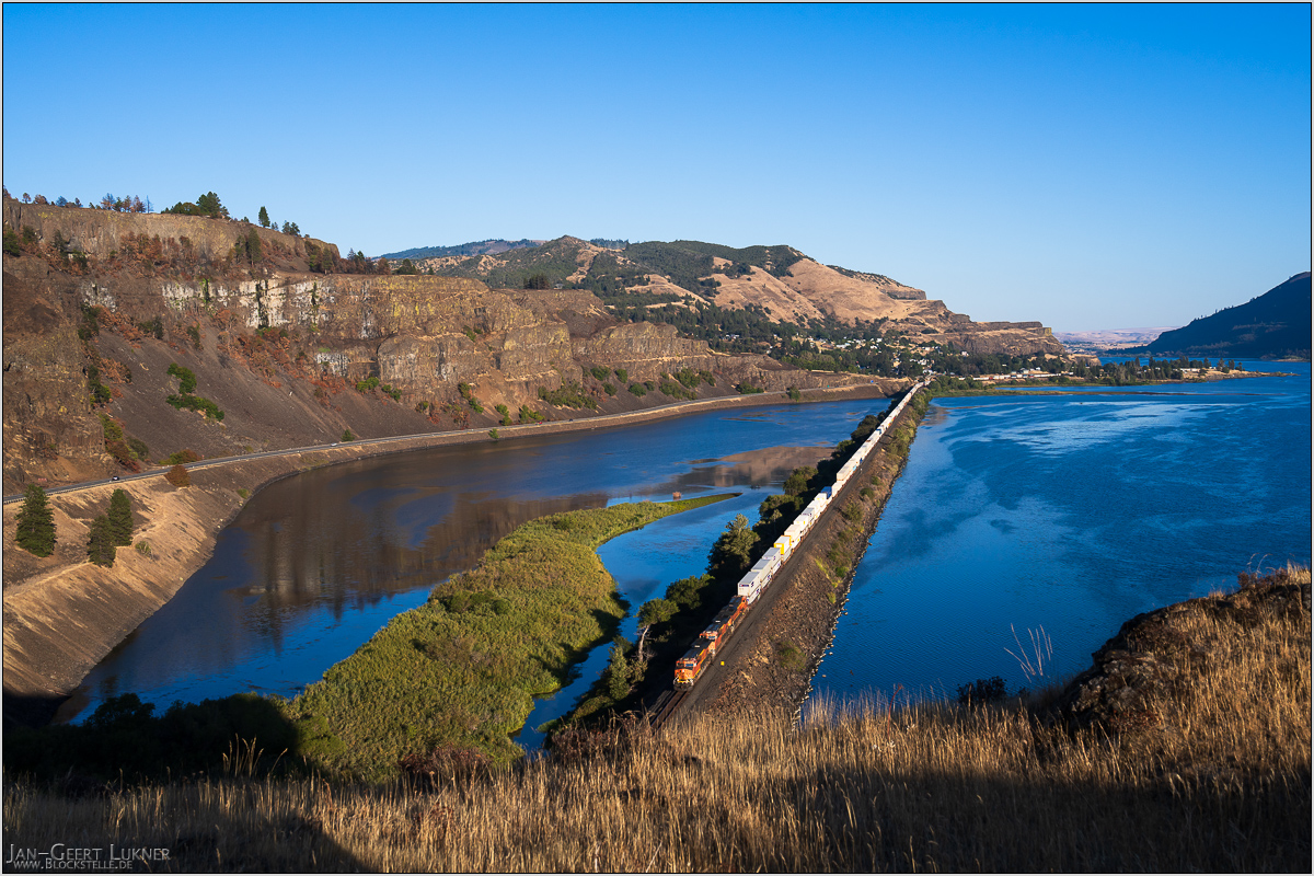
Bild 68. Aufnahmezeitpunkt/Recording time: 15.09.2025 um/at 17:59. Der ungefähre Fotostandpunkt auf/The approximate photo point on Google Maps. nächstes/next hoch/top
Kurzbeschreibung durch hinterlegte Stichwörter/Short description by included keywords:
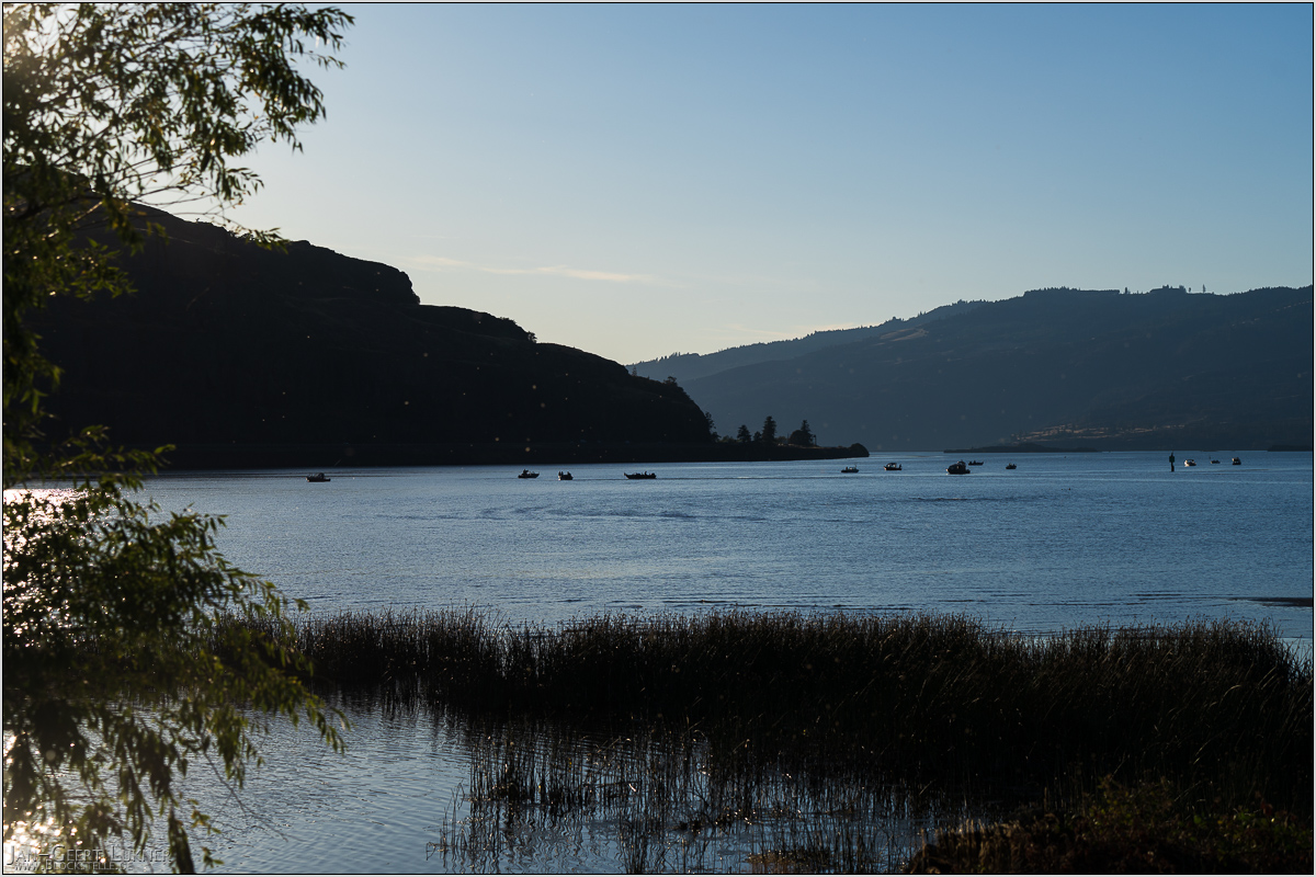
Bild 69. Aufnahmezeitpunkt/Recording time: 15.09.2025 um/at 18:16. Der ungefähre Fotostandpunkt auf/The approximate photo point on Google Maps. nächstes/next hoch/top
Kurzbeschreibung durch hinterlegte Stichwörter/Short description by included keywords:
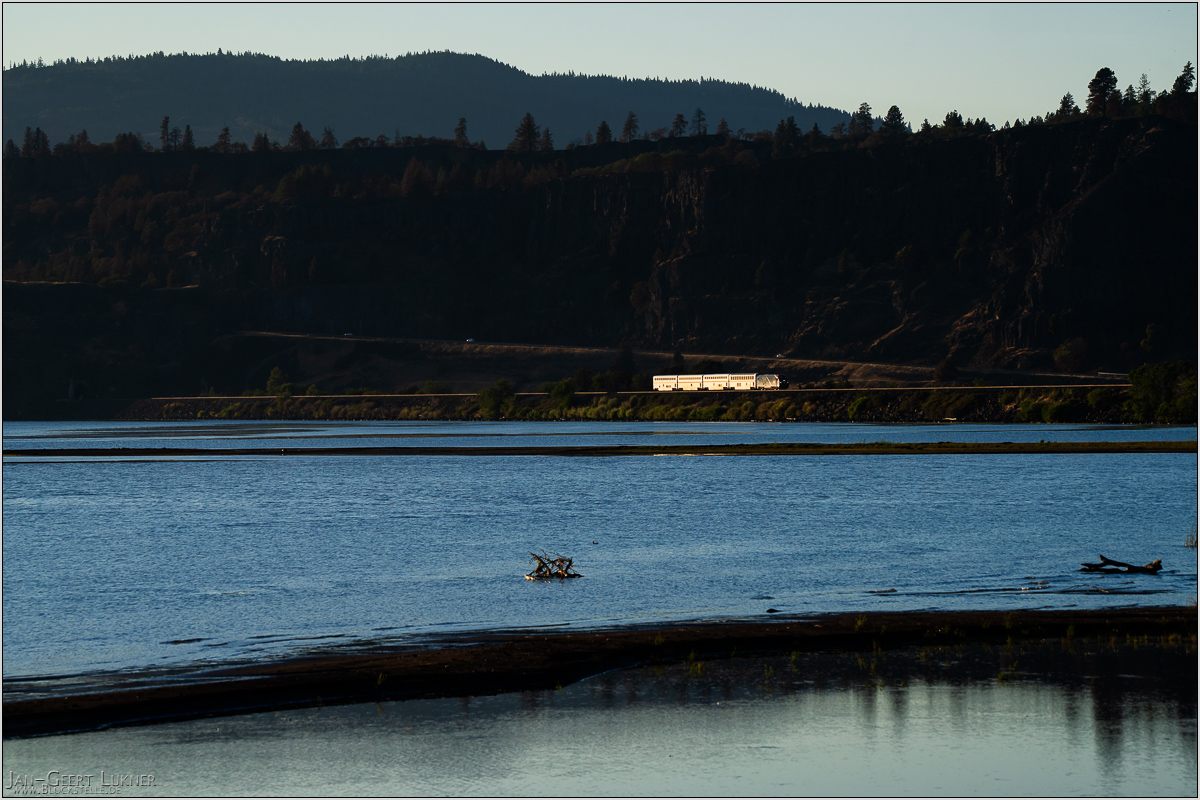
Bild 70. Aufnahmezeitpunkt/Recording time: 15.09.2025 um/at 18:33. Der ungefähre Fotostandpunkt auf/The approximate photo point on Google Maps. nächstes/next hoch/top
Kurzbeschreibung durch hinterlegte Stichwörter/Short description by included keywords:
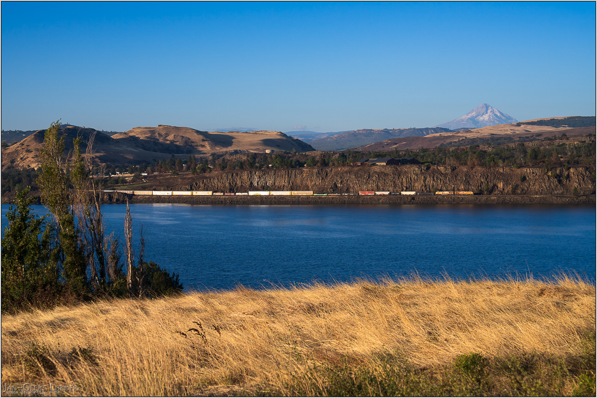
Bild 71. Aufnahmezeitpunkt/Recording time: 16.09.2025 um/at 07:43. Der ungefähre Fotostandpunkt auf/The approximate photo point on Google Maps. nächstes/next hoch/top
Kurzbeschreibung durch hinterlegte Stichwörter/Short description by included keywords:
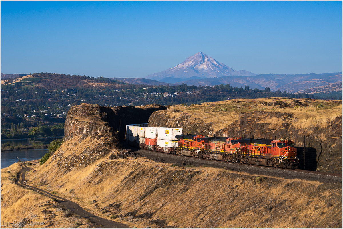
Bild 72. Aufnahmezeitpunkt/Recording time: 16.09.2025 um/at 08:08. Der ungefähre Fotostandpunkt auf/The approximate photo point on Google Maps. nächstes/next hoch/top
Kurzbeschreibung durch hinterlegte Stichwörter/Short description by included keywords:
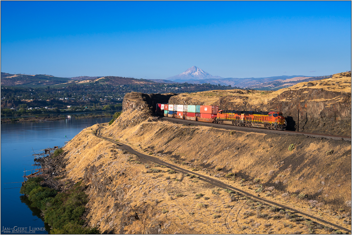
Bild 73. Aufnahmezeitpunkt/Recording time: 16.09.2025 um/at 08:23. Der ungefähre Fotostandpunkt auf/The approximate photo point on Google Maps. nächstes/next hoch/top
Kurzbeschreibung durch hinterlegte Stichwörter/Short description by included keywords:
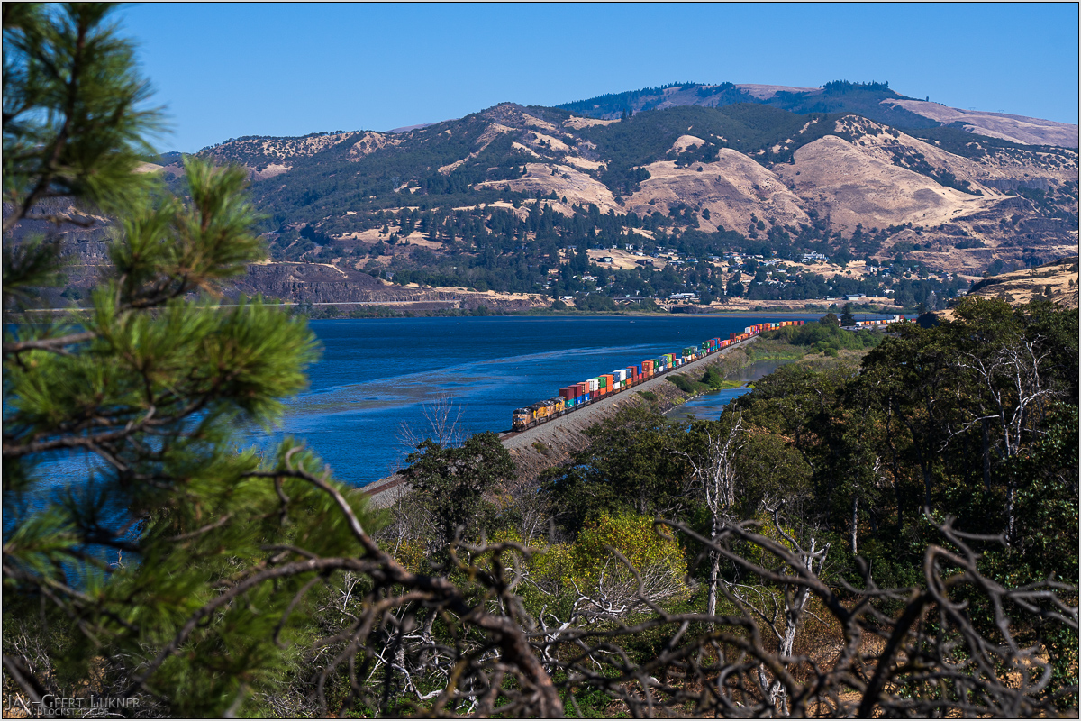
Bild 74. Aufnahmezeitpunkt/Recording time: 16.09.2025 um/at 14:32. Der ungefähre Fotostandpunkt auf/The approximate photo point on Google Maps. nächstes/next hoch/top
Kurzbeschreibung durch hinterlegte Stichwörter/Short description by included keywords:
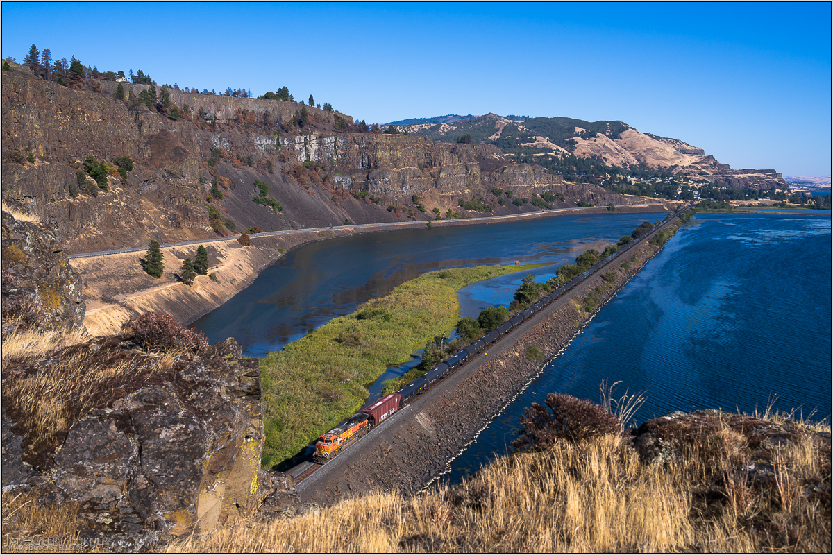
Bild 75. Aufnahmezeitpunkt/Recording time: 16.09.2025 um/at 15:51. Der ungefähre Fotostandpunkt auf/The approximate photo point on Google Maps. nächstes/next hoch/top
Kurzbeschreibung durch hinterlegte Stichwörter/Short description by included keywords:
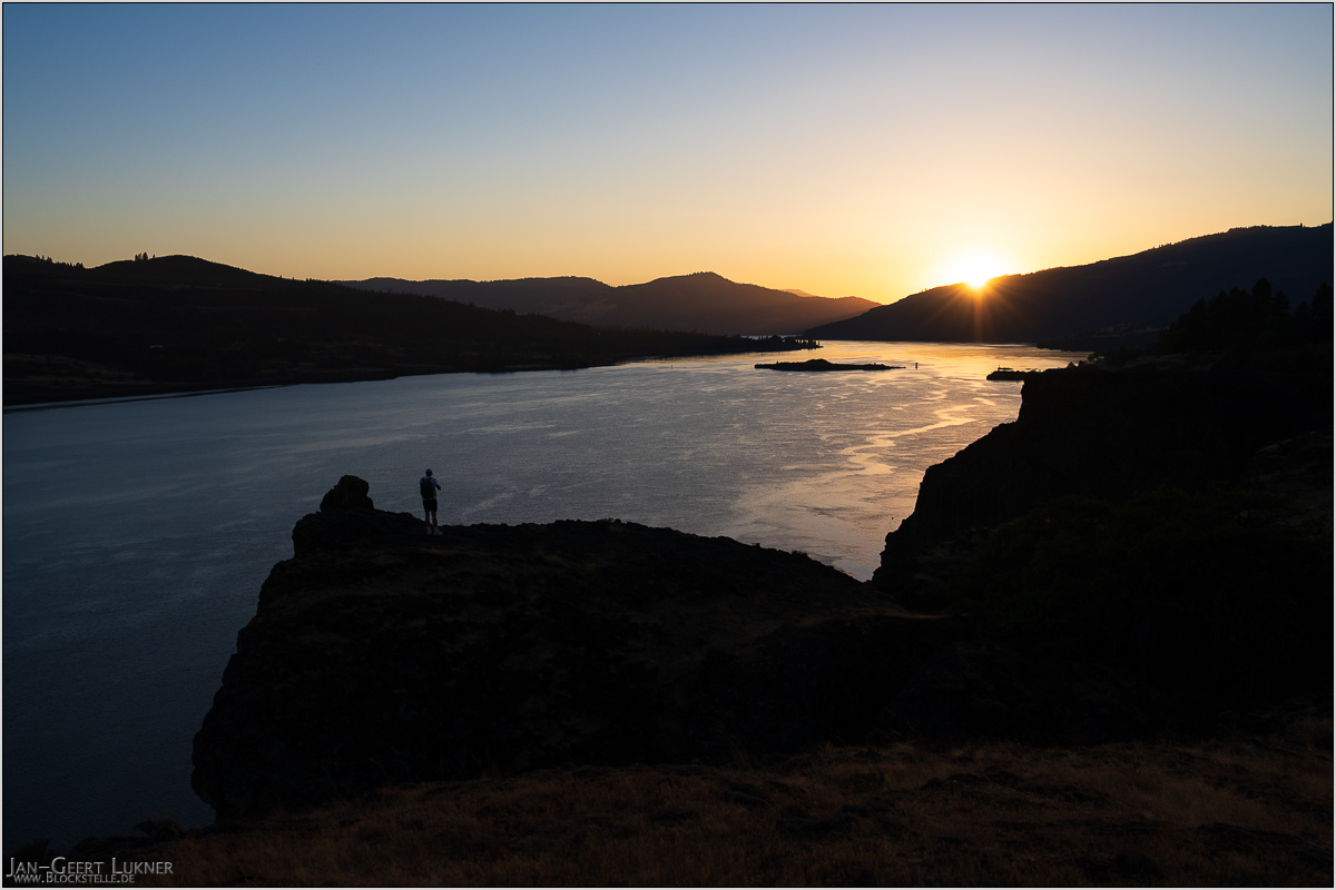
Bild 76. Aufnahmezeitpunkt/Recording time: 16.09.2025 um/at 19:00. Der ungefähre Fotostandpunkt auf/The approximate photo point on Google Maps. nächstes/next hoch/top
Kurzbeschreibung durch hinterlegte Stichwörter/Short description by included keywords:
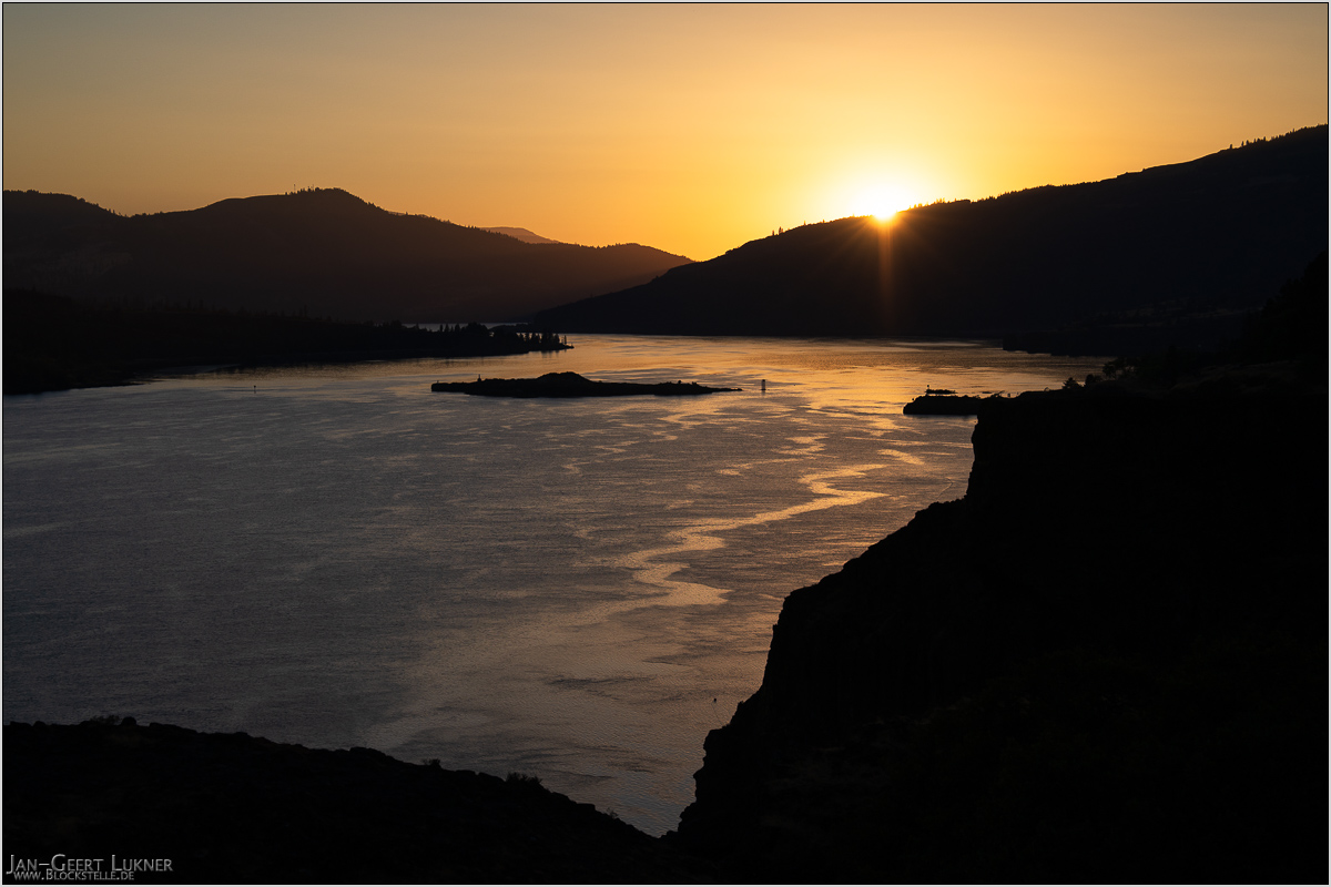
Bild 77. Aufnahmezeitpunkt/Recording time: 16.09.2025 um/at 19:00. Der ungefähre Fotostandpunkt auf/The approximate photo point on Google Maps. nächstes/next hoch/top
Kurzbeschreibung durch hinterlegte Stichwörter/Short description by included keywords:
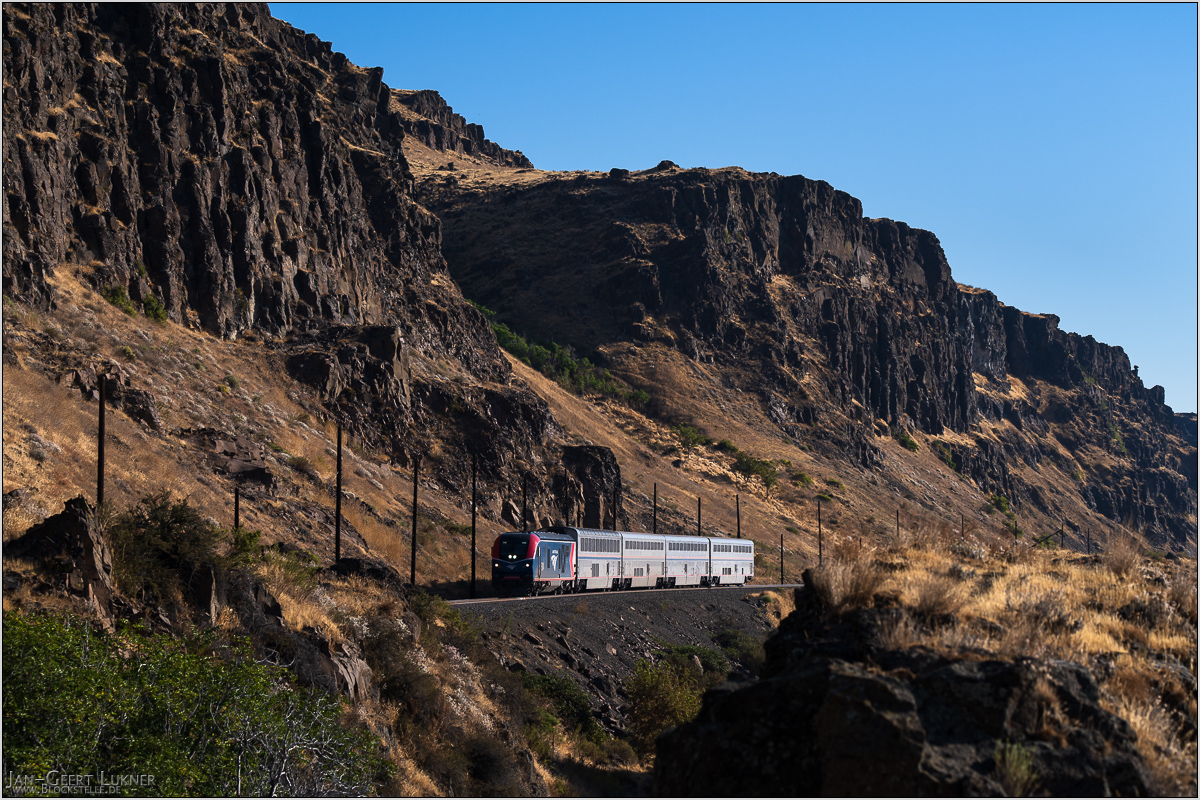
Bild 78. Aufnahmezeitpunkt/Recording time: 17.09.2025 um/at 09:05. Der ungefähre Fotostandpunkt auf/The approximate photo point on Google Maps. nächstes/next hoch/top
Kurzbeschreibung durch hinterlegte Stichwörter/Short description by included keywords:
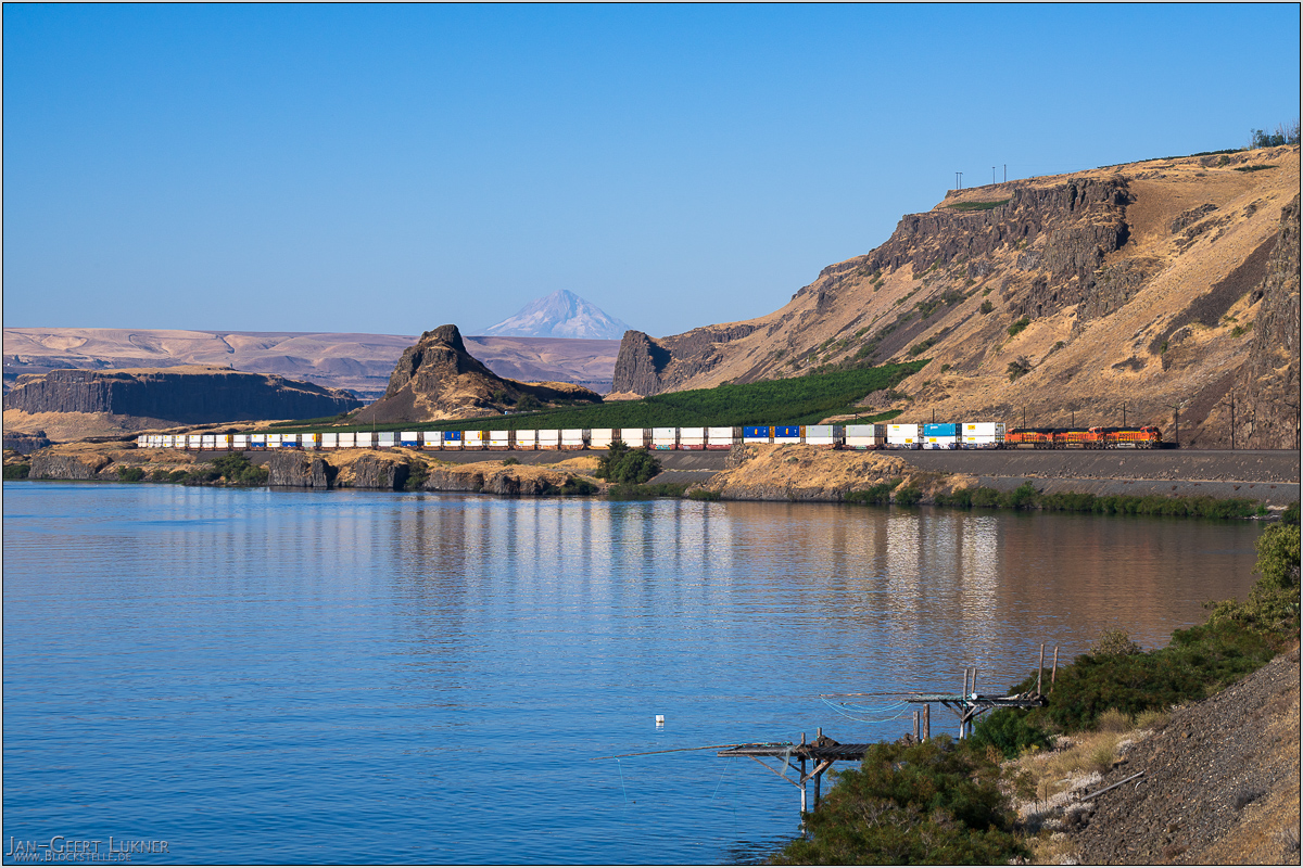
Bild 79. Aufnahmezeitpunkt/Recording time: 17.09.2025 um/at 09:20. Der ungefähre Fotostandpunkt auf/The approximate photo point on Google Maps. nächstes/next hoch/top
Kurzbeschreibung durch hinterlegte Stichwörter/Short description by included keywords:
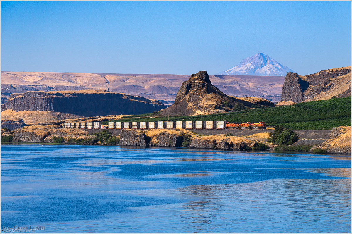
Bild 80. Aufnahmezeitpunkt/Recording time: 17.09.2025 um/at 09:39. Der ungefähre Fotostandpunkt auf/The approximate photo point on Google Maps. nächstes/next hoch/top
Kurzbeschreibung durch hinterlegte Stichwörter/Short description by included keywords:
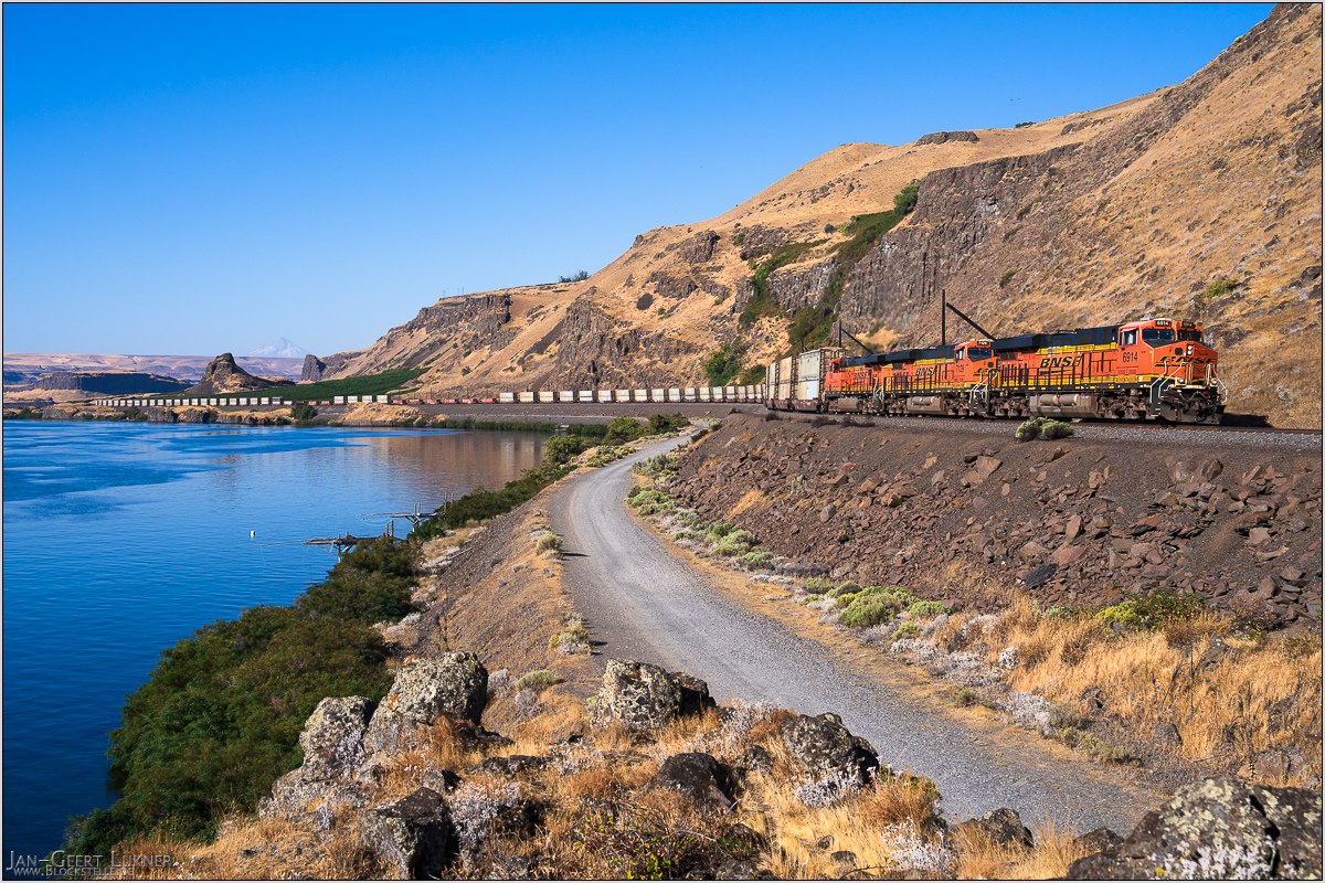
Bild 81. Aufnahmezeitpunkt/Recording time: 17.09.2025 um/at 09:40. Der ungefähre Fotostandpunkt auf/The approximate photo point on Google Maps. nächstes/next hoch/top
Kurzbeschreibung durch hinterlegte Stichwörter/Short description by included keywords:
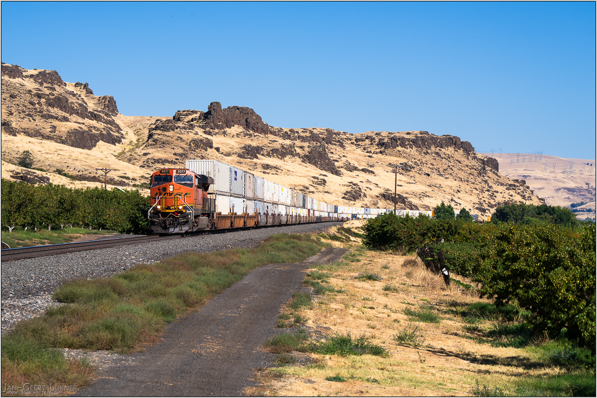
Bild 82. Aufnahmezeitpunkt/Recording time: 17.09.2025 um/at 15:12. Der ungefähre Fotostandpunkt auf/The approximate photo point on Google Maps. nächstes/next hoch/top
Kurzbeschreibung durch hinterlegte Stichwörter/Short description by included keywords:
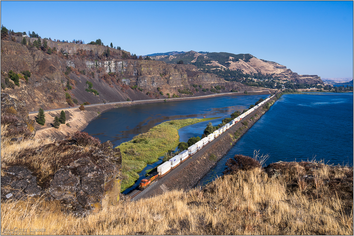
Bild 83. Aufnahmezeitpunkt/Recording time: 17.09.2025 um/at 16:04. Der ungefähre Fotostandpunkt auf/The approximate photo point on Google Maps. nächstes/next hoch/top
Kurzbeschreibung durch hinterlegte Stichwörter/Short description by included keywords:
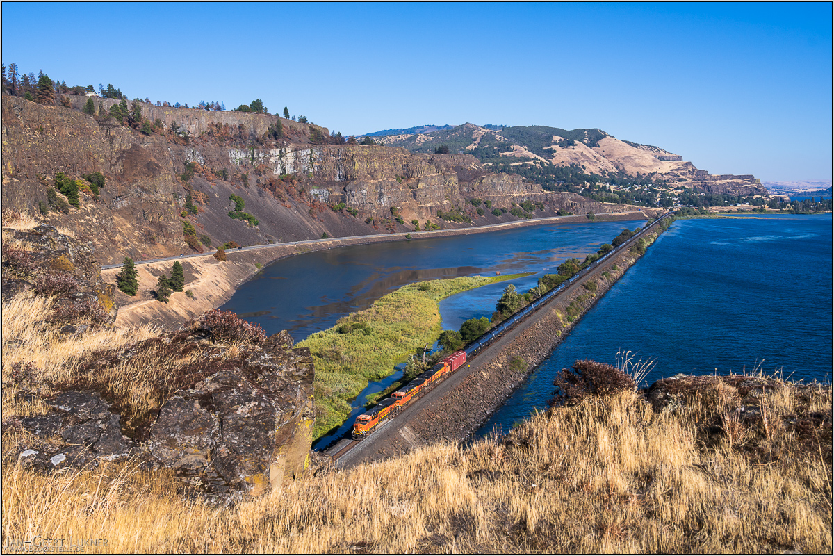
Bild 84. Aufnahmezeitpunkt/Recording time: 17.09.2025 um/at 16:21. Der ungefähre Fotostandpunkt auf/The approximate photo point on Google Maps. nächstes/next hoch/top
Kurzbeschreibung durch hinterlegte Stichwörter/Short description by included keywords:
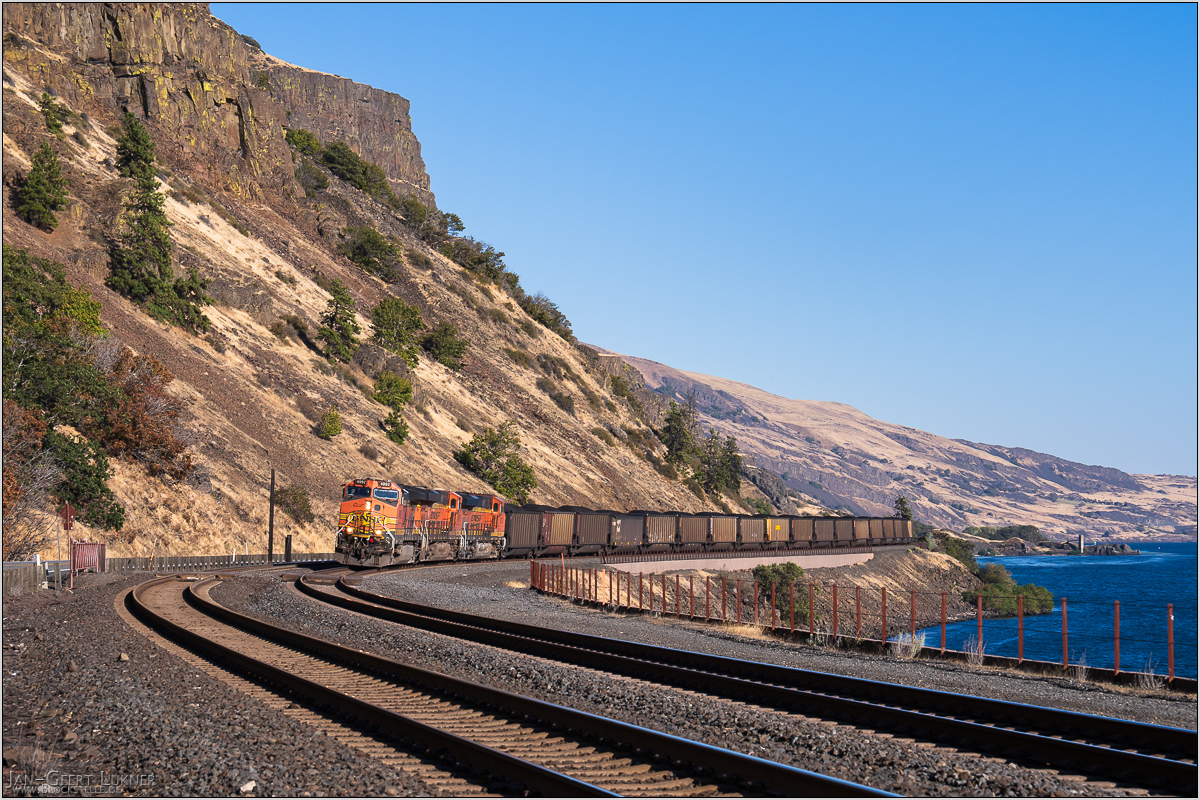
Bild 85. Aufnahmezeitpunkt/Recording time: 17.09.2025 um/at 16:42. Der ungefähre Fotostandpunkt auf/The approximate photo point on Google Maps. nächstes/next hoch/top
Kurzbeschreibung durch hinterlegte Stichwörter/Short description by included keywords:
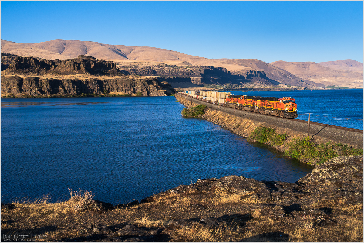
Bild 86. Aufnahmezeitpunkt/Recording time: 17.09.2025 um/at 18:01. Der ungefähre Fotostandpunkt auf/The approximate photo point on Google Maps. nächstes/next hoch/top
Kurzbeschreibung durch hinterlegte Stichwörter/Short description by included keywords:
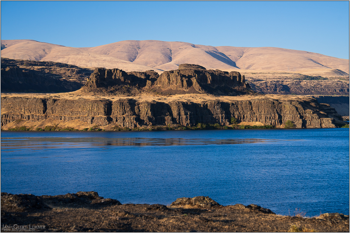
Bild 87. Aufnahmezeitpunkt/Recording time: 17.09.2025 um/at 18:14. Der ungefähre Fotostandpunkt auf/The approximate photo point on Google Maps. nächstes/next hoch/top
Kurzbeschreibung durch hinterlegte Stichwörter/Short description by included keywords:
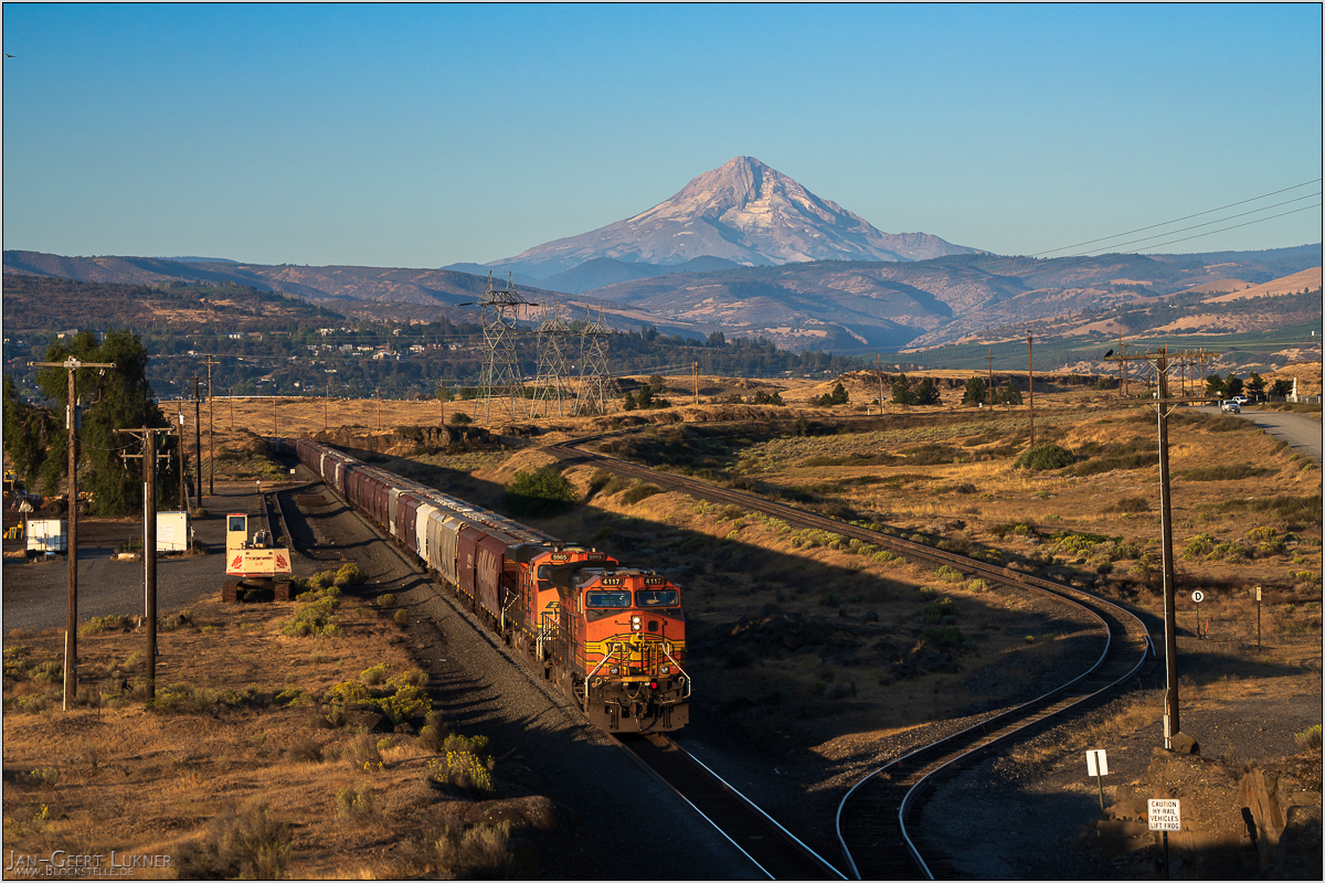
Bild 88. Aufnahmezeitpunkt/Recording time: 18.09.2025 um/at 07:32. Der ungefähre Fotostandpunkt auf/The approximate photo point on Google Maps. nächstes/next hoch/top
Kurzbeschreibung durch hinterlegte Stichwörter/Short description by included keywords:
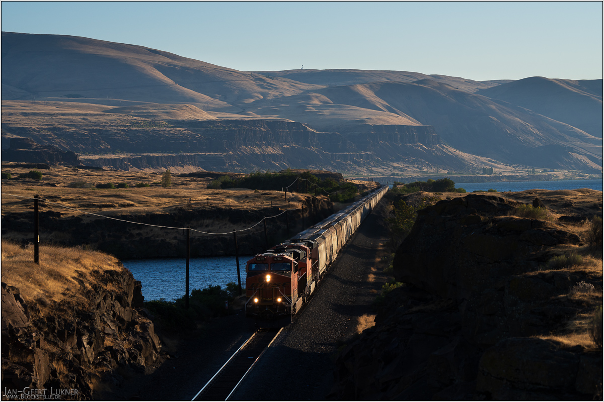
Bild 89. Aufnahmezeitpunkt/Recording time: 18.09.2025 um/at 07:42. Der ungefähre Fotostandpunkt auf/The approximate photo point on Google Maps. nächstes/next hoch/top
Kurzbeschreibung durch hinterlegte Stichwörter/Short description by included keywords:
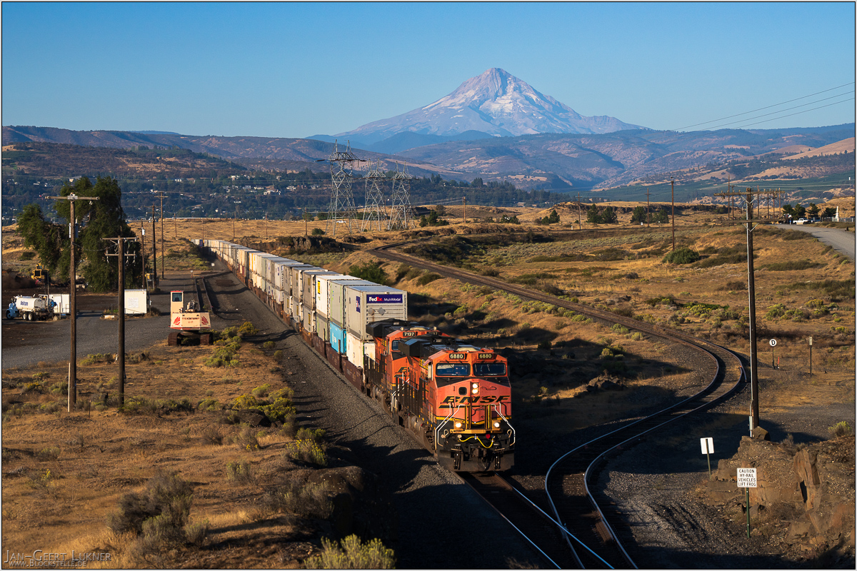
Bild 90. Aufnahmezeitpunkt/Recording time: 18.09.2025 um/at 08:02. Der ungefähre Fotostandpunkt auf/The approximate photo point on Google Maps. nächstes/next hoch/top
Kurzbeschreibung durch hinterlegte Stichwörter/Short description by included keywords:
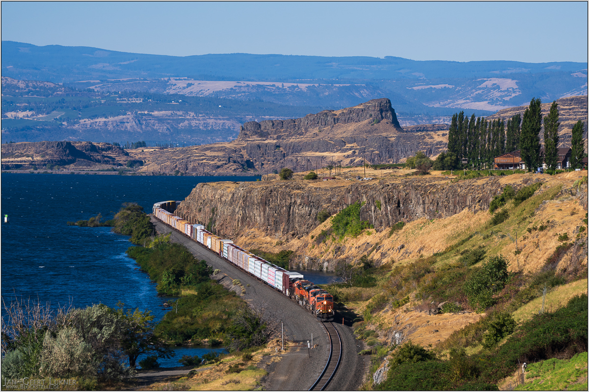
Bild 91. Aufnahmezeitpunkt/Recording time: 18.09.2025 um/at 09:57. Der ungefähre Fotostandpunkt auf/The approximate photo point on Google Maps. nächstes/next hoch/top
Kurzbeschreibung durch hinterlegte Stichwörter/Short description by included keywords:
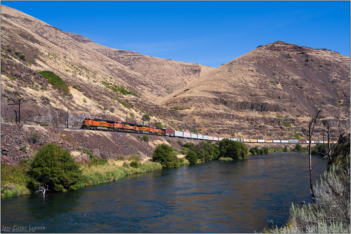
Bild 92. Aufnahmezeitpunkt/Recording time: 18.09.2025 um/at 12:39. Der ungefähre Fotostandpunkt auf/The approximate photo point on Google Maps. nächstes/next hoch/top
Kurzbeschreibung durch hinterlegte Stichwörter/Short description by included keywords:
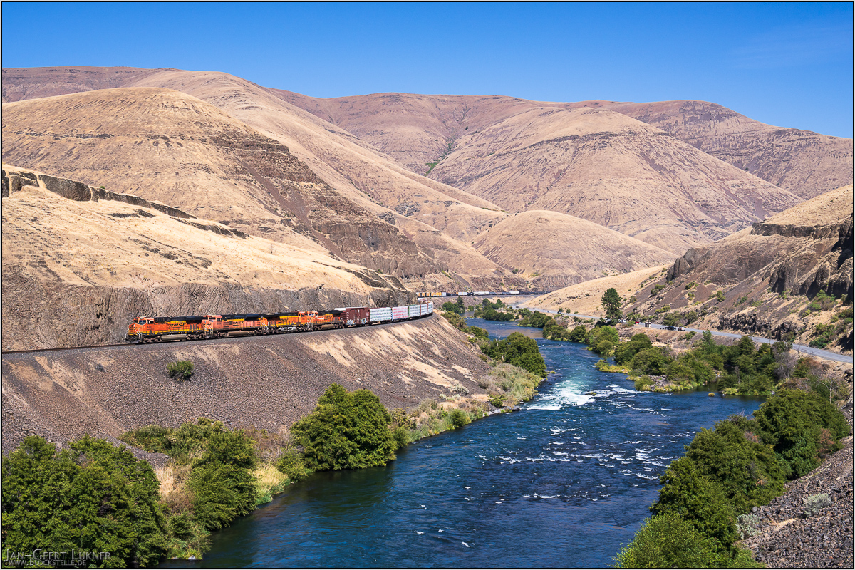
Bild 93. Aufnahmezeitpunkt/Recording time: 18.09.2025 um/at 12:42. Der ungefähre Fotostandpunkt auf/The approximate photo point on Google Maps. nächstes/next hoch/top
Kurzbeschreibung durch hinterlegte Stichwörter/Short description by included keywords:
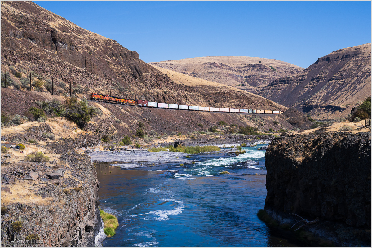
Bild 94. Aufnahmezeitpunkt/Recording time: 18.09.2025 um/at 12:49. Der ungefähre Fotostandpunkt auf/The approximate photo point on Google Maps. nächstes/next hoch/top
Kurzbeschreibung durch hinterlegte Stichwörter/Short description by included keywords:
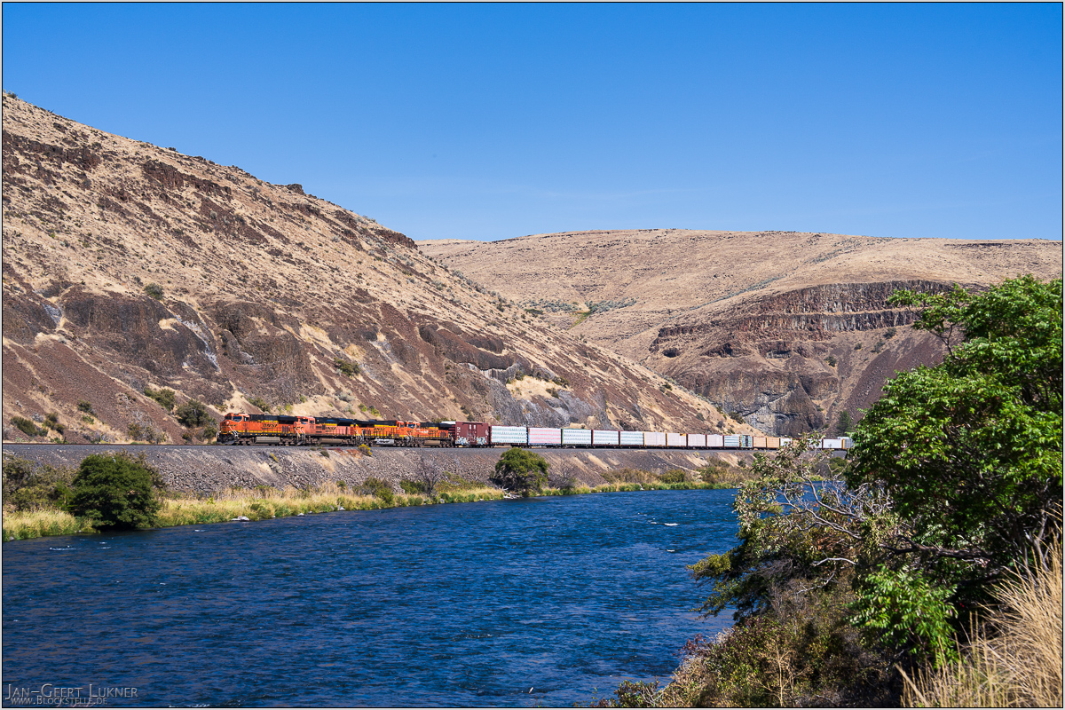
Bild 95. Aufnahmezeitpunkt/Recording time: 18.09.2025 um/at 12:57. Der ungefähre Fotostandpunkt auf/The approximate photo point on Google Maps. nächstes/next hoch/top
Kurzbeschreibung durch hinterlegte Stichwörter/Short description by included keywords:
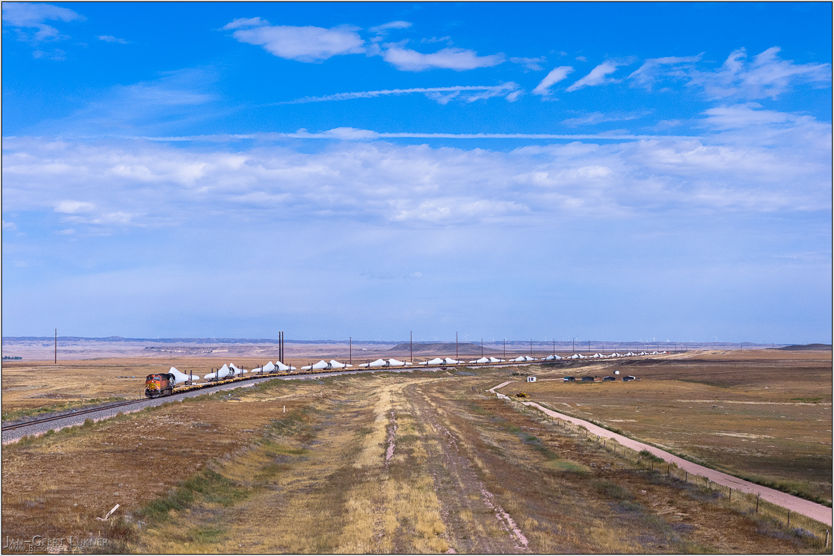
Bild 96. Aufnahmezeitpunkt/Recording time: 20.09.2025 um/at 10:27. Der ungefähre Fotostandpunkt auf/The approximate photo point on Google Maps. nächstes/next hoch/top
Kurzbeschreibung durch hinterlegte Stichwörter/Short description by included keywords:
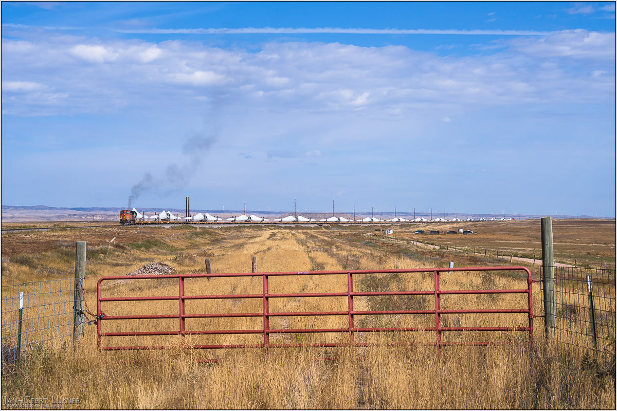
Bild 97. Aufnahmezeitpunkt/Recording time: 20.09.2025 um/at 10:28. Der ungefähre Fotostandpunkt auf/The approximate photo point on Google Maps. nächstes/next hoch/top
Kurzbeschreibung durch hinterlegte Stichwörter/Short description by included keywords:
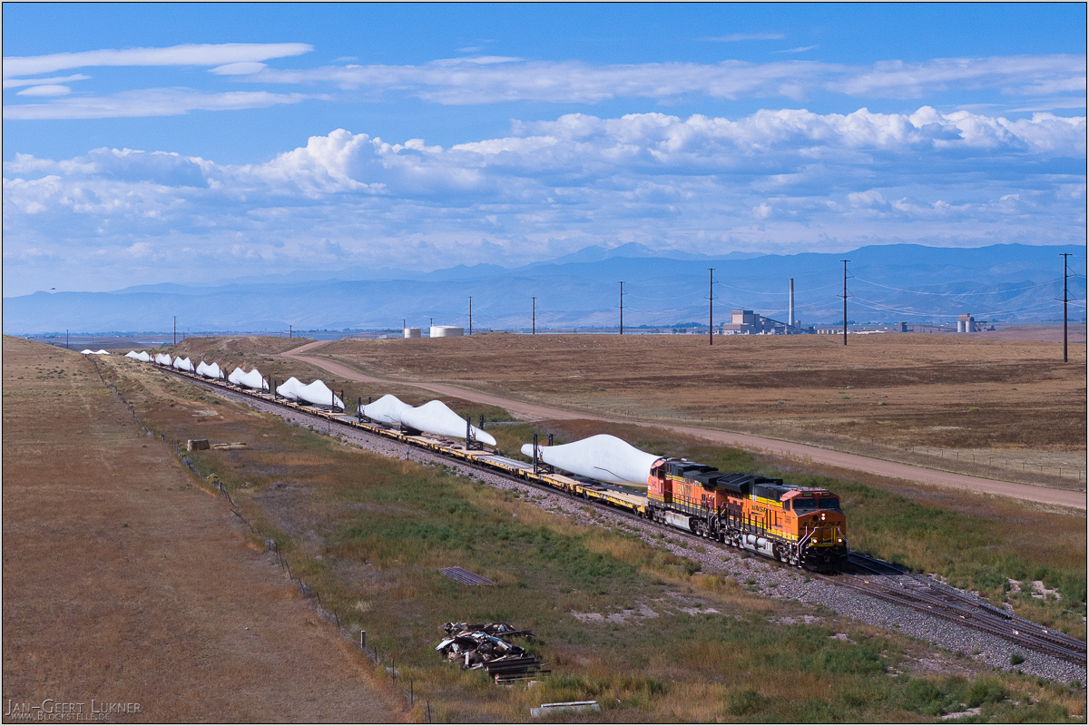
Bild 98. Aufnahmezeitpunkt/Recording time: 20.09.2025 um/at 10:45. Der ungefähre Fotostandpunkt auf/The approximate photo point on Google Maps. nächstes/next hoch/top
Kurzbeschreibung durch hinterlegte Stichwörter/Short description by included keywords:
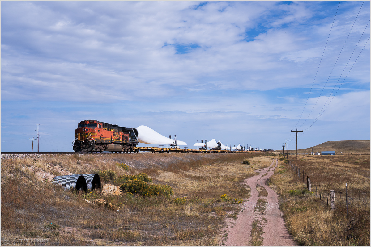
Bild 99. Aufnahmezeitpunkt/Recording time: 20.09.2025 um/at 10:47. Der ungefähre Fotostandpunkt auf/The approximate photo point on Google Maps. nächstes/next hoch/top
Kurzbeschreibung durch hinterlegte Stichwörter/Short description by included keywords:
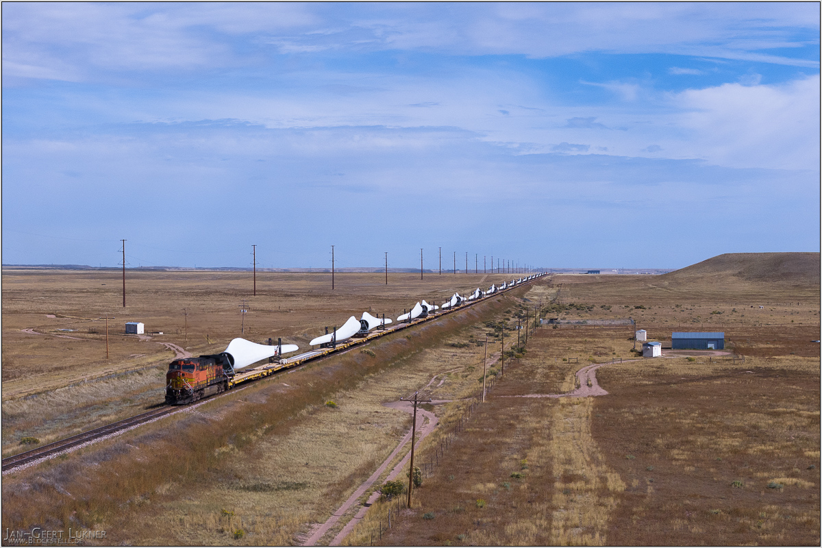
Bild 100. Aufnahmezeitpunkt/Recording time: 20.09.2025 um/at 10:50. Der ungefähre Fotostandpunkt auf/The approximate photo point on Google Maps. hoch/top
Kurzbeschreibung durch hinterlegte Stichwörter/Short description by included keywords:
Zurück zum Eingang . Tilbake til inngangen . Back to the entrance . Zurück zum Archiv . Tilbake til arkivet . Back to the archive